Approximate Location Map
Large Map »
This site is entirely user-supported. See how you can help.
If Google Street View is available, the image is from the best available vantage point looking, if possible, towards the location of the monument. Where it is not available, the satellite view is shown instead.
Latitude: 52.6581 / 52°39'29"N
Longitude: -1.4472 / 1°26'49"W
OS Eastings: 437488.138255
OS Northings: 306856.984509
OS Grid: SK374068
Mapcode National: GBR 6J6.6YB
Mapcode Global: WHDJ5.RG11
Entry Name: Motte and associated earthworks at Shackerstone
Scheduled Date: 10 April 1964
Last Amended: 9 March 1994
Source: Historic England
Source ID: 1008542
English Heritage Legacy ID: 17060
County: Leicestershire
Civil Parish: Shackerstone
Traditional County: Leicestershire
Lieutenancy Area (Ceremonial County): Leicestershire
Church of England Parish: Shackerstone St Peter
Church of England Diocese: Leicester
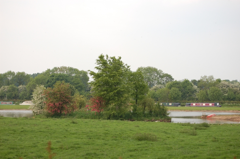
The monument at Shackerstone is situated on the north side of the village and
includes a prominent motte, a fishpond to the north and traces of formal
garden earthworks to the south.
The motte measures 40m in diameter at the base, has a flat area 20m across on
the top and is approximately 4.5m high from the bottom of the ditch. The
ditch encircles the mound with the exception of a 12m stretch on the south-
west, and is up to 2m deep and 6m wide on the south-east side and 1m deep and
8m wide on the north side. A water-filled fishpond measuring 70m long and 12m
wide, formerly connected by a channel to the motte ditch, is situated on the
north side of the motte. A linear scarp, 1m high, which runs south from the
motte ditch on the western side and a 15m long scarp to the south, are the
remains of formal garden earthworks relating to a hall which stood to the
south of the site. A ditch 3m wide and 0.3m deep which drained the motte
ditch on the western side, runs north for 38m before it is altered by later
landscaping. A 35m length of bank 1.5m high which was part of the garden
earthworks stands to the east of the motte and formerly joined the fishpond.
The dam constructed of breeze blocks at the east end of the fishpond is
excluded from the scheduling although the ground beneath is included.
Wartime activity in 1940, during which the motte was disturbed, revealed
evidence of a central post about 350cm in diameter.
MAP EXTRACT
The site of the monument is shown on the attached map extract.
It includes a 2 metre boundary around the archaeological features,
considered to be essential for the monument's support and preservation.
Source: Historic England
Motte castles are medieval fortifications introduced into Britain by the
Normans. They comprised a large conical mound of earth or rubble, the motte,
surmounted by a palisade and a stone or timber tower. In a majority of
examples an embanked enclosure containing additional buildings, the bailey,
adjoined the motte. Motte castles and motte-and-bai1ey castles acted as
garrison forts during offensive military operations, as strongholds, and, in
many cases, as aristocratic residences and as centres of local or royal
administration. Built in towns, villages and open countryside, motte castles
generally occupied strategic positions dominating their immediate locality
and, as a result, are the most visually impressive monuments of the early
post-Conquest period surviving in the modern landscape. Over 600 motte castles
and motte-and-bailey castles are recorded nationally, with examples known from
most regions. Some 100-150 examples do not have baileys and are classified as
motte castles. As one of a restricted range of recognised early post-Conquest
monuments, they are particularly important for the study of Norman Britain and
the development of the feudal system. Although many were occupied for only a
short period of time, motte castles continued to be built and occupied from
the 11th to the 13th centuries, after which they were superseded by other
types of castle.
The motte at Shackerstone, together with a fishpond, survive in good condition
and, apart from some small scale excavation, the mound is essentially
undisturbed and has considerable potential for the survival of archaeological
evidence. It was later incorporated into a formal garden, some earthworks of
which are included in the scheduling.
Source: Historic England
Books and journals
Nichols, J, The History and Antiquities of the County of Leicestershire, (1811), 909
Other
Leicestershire Sites and Monuments Record, (1940)
Source: Historic England
Other nearby scheduled monuments