Approximate Location Map
Large Map »
This site is entirely user-supported. See how you can help.
If Google Street View is available, the image is from the best available vantage point looking, if possible, towards the location of the monument. Where it is not available, the satellite view is shown instead.
Latitude: 52.5228 / 52°31'22"N
Longitude: -0.6349 / 0°38'5"W
OS Eastings: 492714.419494
OS Northings: 292531.331621
OS Grid: SP927925
Mapcode National: GBR DVS.VNW
Mapcode Global: VHFN6.YV6D
Entry Name: Kirby Hall: an Elizabethan country house and gardens, including the remains of the medieval village of Kirby
Scheduled Date: 25 January 1927
Last Amended: 22 May 2014
Source: Historic England
Source ID: 1014421
English Heritage Legacy ID: 17158
County: Northamptonshire
Civil Parish: Bulwick
Traditional County: Northamptonshire
Lieutenancy Area (Ceremonial County): Northamptonshire
Church of England Parish: Weldon with Deene St Mary the Virgin
Church of England Diocese: Peterborough
The standing remains (both ruined and roofed) of Kirby Hall, begun in 1570, and its associated service buildings, as well as the earthwork and buried remains of the formal gardens, laid out in the C17, and the settlement remains of the village of Kirby to the south and north of Gretton Brook, a small settlement established in the late Anglo-Saxon period and fully abandoned by the early C17, including the church and a possible early manor house.
Source: Historic England
The monument includes the standing remains (both ruined and roofed) of Kirby Hall, begun in 1570, the buried remains of associated service buildings and the earthwork and buried remains of the formal gardens, laid out in the C17. Also included are the surviving earthworks and buried remains of the village of Kirby, a small settlement established in the late Anglo-Saxon period and fully abandoned by the early C17.
The Hall, its gardens and the village are sited in a shallow valley, straddling the Gretton Brook, with Kirby Lane, the road between Corby and Deene, to the south. The remains of Kirby Hall, its associated service buildings and the formal gardens are to the north of the brook, which runs from south-west to north-east through the valley, while further remains of the gardens extend south-east from the brook. The main area of the medieval settlement of Kirby was focussed on the church to the south-west and to the south of the Hall, and also to either side of a hollow way that ran east from the brook to Kirby Lane.
HALL
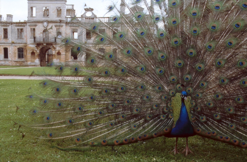
Kirby Hall is a rectangular building constructed of Weldon stone, built on a courtyard plan with a walled forecourt to the north; it partly incorporates the remains of the earlier manor. Excavations undertaken within the west wing in 2011 provided evidence that the site had been levelled down to the limestone bedrock to the north and the ground level raised to the south to create a platform on which to build the Hall. There are four wings ranged around the central courtyard, where each facade is composed of two principal storeys of mullioned and transomed windows; the facades are unified vertically, by the use of giant pilasters extending through both storeys, and horizontally by a tall plinth and by decorative friezes running at ground and first floor lintel level and along the parapet.
The principal wing, on the south side of the Hall is believed to represent a rebuilding of the earlier medieval manor house; the earliest fabric, a two light window partly concealed within the north wall of the stair tower, dates to the mid-C16, and appears to pre-date Sir Humphrey's later C16 house. This includes the great hall and buttery with cellars and kitchen to the south east. The main entrance to the wing is through an elaborate central porch which leads into the east end of the great hall. The hall is roofed and glazed and has an decorative plaster ceiling dated to the late 16th century. At the west end of the hall is a suite of state apartments, also roofed and glazed, which was built after 1575. Approached through two doorways at the dais end of the hall, it is based upon a symmetrical arrangement of two ground floor anterooms, to the north and south respectively of a central parlour, with two staircases projecting to the west; the staircases frame the central doorway of the parlour which was later converted into a window. Attached to the south is a four-storey block, two rooms deep, with semicircular bay windows on the south face.
The remainder of the house is largely unroofed and represented by stone walls standing in most parts to gable height. The east and west wings, which have matching facades to the courtyard, represent the lodging ranges of the hall where visitors would have been accommodated. The first floor of the west wing was occupied by a long gallery approached from the state apartments to the south. The north wing has an open ground floor loggia to the courtyard, beneath which is a series of empty pedimented niches; two symmetrical staircases lead from the ends of the loggia to first floor level. The present form of the north front of the north wing dates largely from the early C17 and unites the ends of the east and west wings, which originally projected northwards, as gabled terminals in a symmetrical facade of alternate shallowly recessed and projecting bays. At the centre is a projecting two storey gateway with chamfered rustication, topped by an elaborate gable. This gateway served as the main entrance to the courtyard.
FORECOURT
On the north side of the house is the forecourt, an open rectangular area which originated as an outer courtyard with outbuildings on the north and east sides, shown on Treswell's map of 1584. After the late C16 these were demolished and the present east and west walls constructed, each with a large pedimented gateway flanked by two tiers of niches. The walls to the north of the gateways are topped by a balustrade; at the centre of the north wall is a smaller pedimented gateway with a scrolled cartouche and chamfered rustication on the north face and vermiculated rustication on the south face. This gateway, and the balustrade with which it is integral, are believed to have originated in the Great Garden to the west of the Hall in the early C17: the balustrade and north face of the gateway date from about 1620, and the south face from a remodelling by the mason Nicholas Stone in about 1640. They are believed to have been moved to the forecourt in the late C17 when the garden was redesigned.
AVENUES AND SERVICE AREA
The forecourt is approached from both the east and west via avenues leading to the main gateways. The western avenue is approximately 110m long and takes the form of two raised banks, about 14m wide, flanking a paved approach road. The eastern avenue, which is level, extends over a distance of approximately 90m. This avenue runs through the service area of the hall where outbuildings such as the laundry, dairy and brewhouse were located. To the south of the avenue is a series of low earthworks, extending over an area of nearly 1ha, representing the remains of these buildings; the earthworks are bounded on the south by the standing fragments of a stone wall with a doorway which represents the south wall of the brewhouse. On the east they are bounded by a trackway which follows the course of a road by which the complex was approached from the south east from the C17 onwards. The service area is believed to have been established by the end of the C17, overlying an earlier road which ran along the eastern edge of the house.
GARDENS
To the south of the service area is an area of lawn which slopes gently down to the stream and extends from the state apartments on the west to the trackway on the east. This area is thought to have been occupied by a medieval and early post-medieval privy garden but is believed to take its present form from informal landscaping of the late C18 when the south wing was reoccupied by the Finch-Hattons. At the south eastern corner of the lawn, approached by the trackway which runs along the eastern edge of the monument, is an ornamental stone bridge about 2m in height. The eastern side of the bridge is faced with an arcade of roundheaded arches of limestone ashlar, all blind except one at the south end which houses a culvert; the top of the bridge and most of the west side are buried beneath the landscaped lawn. Archaeological and documentary evidence has demonstrated that the bridge was formerly ornamented with a balustrade identical to that now in the forecourt. The bridge is thought to have originated in the later C17 when the road to the east of the Hall was diverted to this position, while its remodelling in ashlar is dated to the late C18 when the area adjacent to the west was landscaped.
To the west of Kirby Hall is the formal Great Garden. It takes the form of a flat rectangular platform measuring about 90m x 120m which has been levelled over a natural slope, cutting into the slope on the north and raised above it on the south. It is bounded on the north and west by raised terraces and on the south and south east by low retaining walls. The area of the parterre is laid out for display purposes as a full-scale replica, in grass and gravel cutwork, of the late C17 parterre.
On the north side of the parterre is a raised terrace, about 18m wide and over 2m high, retained internally by a brick wall and externally by a stone wall. On the west side is a bank about 18m wide and 1.5m high; part excavation of the bank has identified the remains of walls, similar to those on the north, which define a shorter and narrower terrace with an opening in the middle. On the south side of the parterre is the base of a wall and the foundations of a central gateway; on the south east side is a buttressed retaining wall. These features, together with finds of other architectural fragments, indicate that the garden was originally completely enclosed by a brick wall topped by a stone balustrade, with a monumental gateway in each of the west and south sides.
From the south wall of the parterre a short flight of stone steps leads down to a flat rectangular terrace of the same width as the parterre and extending about 28m southwards; at its western end is a viewing mound about 2m high known as the Mount. Below the south terrace is a levelled area of the same width which extends nearly 70m to the north bank of the stream, beneath which is a system of rectilinear drainage channels and the remains of an earlier stream bed, detected by geophysical survey. All of these features, including the canalisation of the stream to form part of the garden, date from the late C17 when the Great Garden was opened up and extended southwards over the remains of part of the medieval village.
To the south-east of Gretton Brook is a large pasture field which includes, to the south-west, further remains of formal gardens laid out in the late C17. The remains take the form of low earthworks and buried features occupying a rectangular area approximately 110m wide and 320m long, extending from the brook to Kirby Lane on the south; in the northern part of the field the gardens are built up over the sloping ground surface. The eastern boundary of the garden survives as a linear bank containing the remains of a stone wall; on the western boundary there are the remains of a similar bank and of a linear ditch running at right-angles from the stream. The layout and content of the gardens is known through documentary sources to have included an orchard at the north end and a formal plantation of native and exotic trees, known as the Wilderness, to the south. Both areas were subdivided by linear paths, now partly visible as linear depressions. Fragments of the kerb-stones which bounded the paths have been found in this area.
VILLAGE
The earliest part of Kirby village is likely to have been to the north, focussed on the church. Finds made towards the south end of the west wing of the hall in the course of the excavations undertaken in 2011 indicate earlier medieval occupation here, possibly part of the village. C16 maps identify the location of the church to the south of the Great Garden, and its survival beneath The Mount, a garden feature constructed in the C17, was confirmed by the excavations undertaken between 1987 and 1994. C13 pottery was found within and beneath the foundations of the church, and graves disturbed by the creation of The Mount were also uncovered.
The Deene to Gretton road, which was the main street through the village, is known to have travelled past the Hall to the east, and aerial photographs indicate the survival of building remains within the gardens here. From this main street another street branched west at Gretton Brook, shown on Treswell's late C16 maps travelling along both sides of the stream, with houses to north and south. Slight earthworks to the west of the Great Garden's raised terrace have been interpreted as representing houses along the west side of a short road that branched north from the stream to the church. Another of the houses, set slightly to the north and west, survives as a building platform in the ploughed field to the west of the gardens, while stone rubble to the south of this indicates a second building. Earthworks and a concentration of stone rubble on the south side of Gretton Brook can be identified with Lanes Farm on the 1584 map, the earthworks representing the boundaries of the farmstead, standing no more than 0.2m high, and also possibly the edge of the stream-side track.
Where the Deene to Gretton road continues south of Gretton Brook, it survives under pasture as a hollow way travelling from west-east, curving slightly south-east at the point where it opens out before meeting Kirby Lane. Treswell's maps of 1584 and 1587 show it feeding into Kirby Green to the east, and also opening to form a funnel shape at its west end by the brook, where the ground now simply flattens out. Lining either side of the hollow way are clearly defined buildings and yards surviving as earthworks and limestone walls; these are best-preserved towards the east end of the street. The English Heritage survey of 2013 identifies four, or possibly five, farmsteads with buildings facing on to the south side of the street, each plot apparently based on a 60m street frontage. To the north of the road are farmsteads that take a slightly different form, with buildings arranged around a yard that opens onto the street. Two of these can be clearly identified, one to the west and one at the east end of the hollow way. That to the west lies partly in the field to the north, where further structures can be seen as a soil mark and scatter of stone rubble; these are clearly identifiable on an aerial photograph of 1957 as earthworks, at that time still under pasture. A third, to the east of this, survives as slight earthworks and as a spread of stone rubble in the field to the north. The farmstead to the east is the best-preserved of all, surviving as upstanding earthworks and limestone walls clearly identifiable as buildings arranged around three sides of a sunken yard, the main two cell range furthest from and parallel to the street. Immediately to the west of this is a farmstead that seems to have opportunistically adopted a former lane, leading into the fields, as a yard.
Towards the west, and north of the street, is a complex of earthworks representing two sunken yards, one facing onto the street and one to the rear, separated by a principal range of buildings running parallel to the street, with ancillary structures arranged around the yards and to the east. This complex is within an enclosure that measures about 60m from north to south and 120m from east to west, defined, respectively, to west and south by Gretton Brook and the village street, and to the north and east by a broad bank standing about 0.4m high. This appears to be a much larger, more elaborate, and higher status version of the other yard-based farmsteads to the north of the street, occupying a double sized plot, and has been identified as a medieval manorial enclosure. One explanation for its presence may be that it represents the earliest manorial centre at Kirby, replaced by the predecessor to the Hall. Because the land south of the brook lay in Deene parish, and was in separate ownership until the C16, this is considered unlikely. If this is a manorial complex, the favoured explanation is that it was the administrative centre for the other half of the manor of Kirby, jointly held from at least the early C13. Although there is no documentary evidence for this, its naming as Hall Close on Treswell's late C16 maps may lend support to this theory. Alternatively, this name may derive from its proximity to the Hall.
Slightly fragmentary and degraded ridge and furrow can be seen between the village and the gardens to the south of Gretton Brook.
EXTENT OF SCHEDULING
The scheduled area includes the full known extent of the surviving remains of Kirby Hall, its outbuildings and gardens, together with the surviving remains of the medieval settlement of Kirby to both north and south of Gretton Brook, as well as associated ridge and furrow cultivation. The boundaries of the scheduled area for the most part follow those of the scheduling amendment of 1996 and unless otherwise stated, the line falls on the inside of boundaries defined on the ground by fences, tracks roads and other markers. To the south-east the scheduling boundary follows the north side of Kirby Lane, before turning north-west, where the north-east boundary follows the field boundary, except for two places where it extends into the neighbouring field. At the south end, where the boundary turns north-west from the road it takes in a rectangle about 20m wide to take in part of the well preserved farmstead under pasture to the south-west. It turns to rejoin the field boundary where that turns to the south-east, but where the field boundary turns again to the north-west, the scheduled area extends again into the field, creating a rough triangle measuring c.142m from south-east to north-west, and at its widest point to the north-west, projects c.60m into the field. To the north-west, the scheduling boundary follows that of Hall and gardens. The boundary then turns south-east, skirting the car park on its east side, and taking a right-angled turn to the west, turning south again to follow the line of the track for about 75m, turning west again to meet the boundary between the field and the gardens, where it turns south-east, following that boundary as far as Kirby Lane.
EXCLUSIONS
All modern buildings and structures, as well as fence and gate posts, are excluded from the scheduling, but the ground beneath them is included.
Source: Historic England
Kirby Hall, its gardens and the medieval settlement of Kirby are scheduled for the following principal reasons:
* Survival: for the exceptional earthworks depicting the form and plan of the settlement to the south-east of the hall, and also for the survival of archaeology within the ploughed fields to the east and west. The exceptionally well preserved remains of Kirby Hall represent over a hundred years of building activity which has been relatively unaltered by later work, while evidence of the plan of the gardens also survives, now recreated;
* Potential: stratified archaeological deposits within areas where earthworks and cropmarks survive well will inform our understanding of both occupation and abandonment, as well as local, regional and national settlement dynamics, and their underlying social, political and economic forces. The earthworks and buried archaeological deposits of dwellings overlain by the Hall and gardens, and the service buildings and yards associated with the house, will preserve structural, artefactual and ecofactual remains of the phases of occupation and abandonment, and valuable evidence for domestic and economic activity;
* Documentation: our understanding of the Hall, gardens and village is significantly enhanced by the survival and study of a variety of documentary sources which offer precise dates, descriptions and a unique record of the social impact of activities which have been identified archaeologically;
* Group value: for the close relationships between elements of the scheduling, and their relationship to designated monuments contemporary with the development of the Hall;
* Diversity: for the range and complexity of features including the Hall, with its range of service buildings, and remains of the village comprising dwellings, walls and yards of tofts and crofts, trackways, and also ridge and furrow, providing an exceptionally clear plan of the settlement. These will retain significant stratified deposits which serve to provide details of the continuity and change in the evolution of the settlement.
Source: Historic England
Books and journals
Allison, K J, Beresford, M W, Hurst, J G, The Deserted Villages of Northamptonshire, (1966)
Astill, G, Grant, A, The Countryside of Medieval England, (1988)
Aston, M, Austin, D, Dyer, C(eds), The Rural Settlements of Medieval England: Studies dedicated to Maurice Beresford and John Hurst, (1989)
Christie, N, Stamper, P (eds), Medieval Rural Settlement: Britain and Ireland AD 800-1600, (2012)
Dyer, C, Jones, R, Deserted Villages Revisited, (2010)
Hall, D, Turning the Plough. Midland Open Fields;landscape character and proposals for management, (2001)
Hall, SC, The Baronial Halls and Ancient Picturesque Edifices of England, (1858)
Hall, D, The Open Fields of Northamptonshire, (1995)
Jamieson, E , Kirby Hall Northamptonshire. The Garden and Settlement Remains Surrounding the Elizabethan Mansion House Archaeological survey report, (2013)
Lewis, C, Mitchell-Fox, P, Dyer, C , Village, Hamlet and Field: Changing Medieval Settlements in Central England, (1997)
Morris, S, The Archaeological Trial Trench Evaluation in the West Range, Kirby Hall, Northamptonshire Dec 2011 , (2012)
Partida, T, Hall, D, Foard, G, An Atlas of Northamptonshire The Medieval and Early-Modern Landscape, (2013)
Pevsner, N, Cherry, B, The Buildings of England: Northamptonshire, (1973), 279-283
Roberts, B K, Wrathmell, S, An Atlas of Rural Settlement in England, (2003)
Williamson, T., Partida, T, Champion. The Making and Unmaking of the English Midland Landscape, (2013)
Dix, B, Soden, I, Hylton, T, 'Archaeological Journal Vol. pp152 291-380' in Kirby hall and its garden excavations in 1987-1994., (1995)
Sladen, T, 'Journal of Garden History' in The Garden at Kirby Hall 1570-1700, , Vol. v 4 n 2, (1984), 139-156
Websites
Rockingham Forest Trust Heritage Resource Centre. , accessed from resource.rockingham-forest-trust.org.uk
Other
Ancient Monuments Laboratory Report, Linford, Neil, Kirby Hall, Northamptonshire, (1992)
fieldwalking survey 25.10.1989, Morris, S, Kirby Hall Survey, (1989)
Northamptonshire Historic Environment Record (HER),
PIC MIDL drawing no.AD2/1, English Heritage, Kirby Hall Ornamental Bridge, (1992)
Royal Commission on Historical Monuments, An Inventory of the Historical Monuments in the County of N, Archaeological Sites in Central Northamptonshire, (1979)
Royal Commission on Historical Monuments, An Inventory of the Historical Monuments in the County of N, Archaeological Sites in North-East Northamptonshire, (1975)
Source: Historic England
Other nearby scheduled monuments