Approximate Location Map
Large Map »
This site is entirely user-supported. See how you can help.
If Google Street View is available, the image is from the best available vantage point looking, if possible, towards the location of the monument. Where it is not available, the satellite view is shown instead.
Latitude: 52.5481 / 52°32'53"N
Longitude: -2.8199 / 2°49'11"W
OS Eastings: 344497.036391
OS Northings: 294792.060261
OS Grid: SO444947
Mapcode National: GBR BF.DJG4
Mapcode Global: VH75V.26KY
Entry Name: Bodbury Ring: a large univallate hillfort on the summit of Bodbury Hill.
Scheduled Date: 17 October 1930
Last Amended: 23 February 1994
Source: Historic England
Source ID: 1009309
English Heritage Legacy ID: 19122
County: Shropshire
Civil Parish: Church Stretton
Traditional County: Shropshire
Lieutenancy Area (Ceremonial County): Shropshire
Church of England Parish: Church Stretton
Church of England Diocese: Hereford
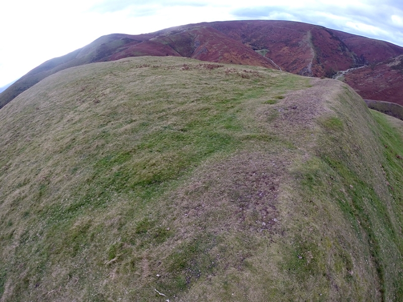
The monument includes a large univallate hillfort, incorporating a cross dyke,
a portion of field bank and representative sample of ridge and furrow. The
hillfort occupies a strong defensive position on the southern tip of Bodbury
Hill, a steep sided promontory on the north side of Carding Mill Valley. The
hillfort is roughly pear shaped in plan, measuring some 120m north-east to
south-west by 100m transversely, and has an enclosed area of just under 1ha.
The defences are designed to make maximum use of the topography. They include
a strong north-east facing rampart 6m to 10m wide and up to 1.7m high
internally, rising 3.5m above the base of an outer ditch 8m wide and 1.3m
deep. This rampart lies orientated roughly NNW to ESE across the neck of the
spur to protect the natural approach from the north. The outer ditch fades out
towards the eastern end of the rampart, before the steepening of the natural
slope, to allow a simple entrance through the rampart at the break of slope.
This rampart may be the earliest part of the earthworks and it may originally
have functioned as a cross-dyke. The cross-dyke would then have been
incorporated into a more comprehensive system of defences at a later date to
create a hillfort. Around the remainder of the hillfort the natural slope of
the hill has been cut back to artificially steepen the slope and create a
strong scarp 7m wide and between 3m and 3.5m high with an outer berm 2m wide.
Beyond the berm the hillslope continues to fall away precipitously. A low
inner bank averaging 0.2m high can be traced running from the north-eastern
rampart to fade approximately half way along the west side. The interior of
the fort reflects the underlying geology so that, although it remains fairly
level along the north-east, south-west axis of the hill, it falls quite
steeply on either side to the ramparts.
A later field boundary bank, averaging 1m wide and 0.3m high, approaches the
hillfort from the east. It runs along the north-eastern portion of the outer
edge of the cross-ridge ditch, then temporarily fades out before continuing to
the north, following around the edge of the hill. To the north of this feature
there are vestigial traces of ridge and furrow orientated roughly east to west
and averaging 2m wide.
MAP EXTRACT
The site of the monument is shown on the attached map extract.
It includes a 10 metre boundary around the archaeological features,
considered to be essential for the monument's support and preservation.
Source: Historic England
Large univallate hillforts are defined as fortified enclosures of varying
shape, ranging in size between 1ha and 10ha, located on hilltops and
surrounded by a single boundary comprising earthworks of massive proportions.
They date to the Iron Age period, most having been constructed and used
between the fourth century BC and the first century AD, although evidence for
earlier use is present at most sites. The size of the earthworks reflects the
ability of certain social groups to mobilise the labour necessary for works on
such a monumental scale, and their function may have had as much to do with
display as defence. Large univallate hillforts are also seen as centres of
redistribution, both for subsistence products and items produced by craftsmen.
The ramparts are of massive proportions except in locations where steepness of
slope precludes easy access. They can vary between 6m and 20m wide and may
survive to a height of 6m. The ditches can measure between 6m and 13m wide and
between 3m and 5m deep. Access to the interior is generally provided by one or
two entrances which often take the form of long passages formed by inturned
ramparts and originally closed by a gate located towards the inner end of the
passageway. The entrance may be flanked by guardrooms and/or accompanied by
outworks. Internal features included timber or stone round houses; large
storage pits and hearths; scattered postholes, stakeholes and gullies; and
square or rectangular buildings supported by four to six posts, often
represented by postholes, and interpreted as raised granaries. Large
univallate hillforts are rare with between 50 and 100 examples recorded
nationally. Most are located within southern England where they occur on the
chalklands of Wessex, Sussex and Kent. The western edge of the distribution is
marked by scattered examples in north Somerset and east Devon, while further
examples occur in central and western England and outliers further north.
Within this distribution considerable regional variation is apparent, both in
their size, rampart structure and the presence or absence of individual
components. In view of the rarity of large univallate hillforts and their
importance in understanding the organisation and regional structure of Iron
Age society, all examples with surviving archaeological remains are believed
to be of national importance.
The large univallate hillfort called Bodbury Ring survives well and is a good
example of its class. The interior is undisturbed and will contain
archaeological evidence relating to the occupation of the hillfort. The
perimeter defences will preserve archaeological material and environmental
evidence relating to the landscape in which the monument was constructed and
the economy of its inhabitants. A portion of a later field bank, which runs
for a part of its length along the outer edge of the main rampart ditch,
together with a representative sample of adjacent ridge and furrow, are
included in the scheduling as evidence for the development and changing land
use of the area.
Source: Historic England
Other
AP NMR SO4494-95, AP NMR SO4494-95,
Source: Historic England
Other nearby scheduled monuments