Approximate Location Map
Large Map »
This site is entirely user-supported. See how you can help.
If Google Street View is available, the image is from the best available vantage point looking, if possible, towards the location of the monument. Where it is not available, the satellite view is shown instead.
Latitude: 53.2004 / 53°12'1"N
Longitude: -0.9243 / 0°55'27"W
OS Eastings: 471956.150896
OS Northings: 367575.858735
OS Grid: SK719675
Mapcode National: GBR BHM.75B
Mapcode Global: WHFGV.ST2C
Entry Name: Motte and bailey castle and associated medieval and post-medieval manorial remains, including six fishponds
Scheduled Date: 30 November 1925
Last Amended: 22 February 1994
Source: Historic England
Source ID: 1008188
English Heritage Legacy ID: 23204
County: Nottinghamshire
Civil Parish: Laxton and Moorhouse
Built-Up Area: Laxton
Traditional County: Nottinghamshire
Lieutenancy Area (Ceremonial County): Nottinghamshire
Church of England Parish: Laxton
Church of England Diocese: Southwell and Nottingham
This monument at Laxton includes the motte and bailey castle and associated
medieval and post-medieval manorial remains. The latter include the sites of
a 13th century hall and dovecote, a postmill mound on top of the motte,
the site of a Tudor manor house built in the outer bailey, six fishponds, a
hollow way which leads north-westward from the castle earthworks to the
fishponds, a second hollow way leading from Hall Lane, and buildings and a
pond-bay associated with the fishponds. Not included in the scheduling is the
green way known as Hall Lane. Although further remains relating to the
medieval and post-medieval sites are believed to survive in connection with
this lane, their extent and state of survival is not sufficiently understood
for them to be included in the scheduling.
The castle has a substantial flat-topped mound or motte situated on the north
side of a roughly square inner bailey. Extending to the south and east is a
large sub-rectangular outer bailey. The motte is c.10m high from the base of
the surrounding ditch and roughly circular, the diameter of its summit being
40m from east to west by 37m from north to south. A slight bank, c.0.5m high
by 2m wide, extends round the rim of the motte and may represent the stone
foundations of a shell keep. Lying centrally on the motte is a flat-topped
circular mound measuring 3m high by 11m wide. This feature is later than the
castle and has been interpreted as a postmill mound, though it could
alternatively have been a prospect mound.
The motte is surrounded by a 10m wide ditch measuring 5m deep. On the south
side this ditch is crossed by an 8m wide ramp which leads onto the motte from
the inner bailey. The inner bailey is enclosed by a substantial rampart
which, from the bailey side, varies between 2m and 3m high. The area enclosed
is roughly 70m square and contains numerous features which include building
platforms, a circular hollow which may be a well and two rectangular
depressions which have the appearance of sunken floors or small cellars. A
circular enclosure lies to the west of the inner bailey and is a level area
with a diameter of c.30m partially enclosed by a shallow 10m wide ditch and a
low inner bank measuring 1m high and 2m wide. A sally-port or secondary gate
leads out of the bailey at the north-east corner while one of two main
entrances lies at the south-east corner. The sally port opens onto a 8m wide
berm or terrace, which divides the bailey rampart on the east side from the
outer ditch which is also 8m wide and c.2m deep. It also leads to a narrow
causeway which crosses the bailey ditch at the point where it meets the ditch
around the motte. Just north of this point is a 4m high outwork surrounded by
its own shallow ditch. A second sally port descends from the top of the bailey
rampart on the south side and crosses into the outer bailey via a causeway
across the inner bailey ditch. This section of the ditch is very substantial,
measuring c.15m wide by 4m deep and with a 1m high counterscarp bank running
along the southern edge. From the outside, the inner bailey rampart is
steeper than from the inside and much higher at between 5m and 6m high.
The outer bailey measures 150m from east to west by 120m from north to south.
It is enclosed by a rampart which varies in height from c.1.5m to c.3.m and
is flanked on the west and east sides by a 8m wide outer ditch. The most
substantial section of the rampart extends along the east side of the bailey.
Narrow breaks in this earthwork, and possibly also in the earthwork on the
west side, are interpreted as additional sally-ports while wider gaps located
near the north-east corner and on the south side leading from Hall Lane may
represent original entrances. At the north-east corner of the outer bailey,
where the rampart and ditch curve westward towards the inner bailey ditch, is
a roughly circular mound measuring c.10m wide by 2m high. This earthwork
overlooks a gap between the inner and outer bailey defences and is interpreted
as the site of a building or tower guarding the approach to the ramp which
leads from the outer bailey to the inner at the latter's south-east corner.
This ramp is c.15m wide and is bisected along its length by the remains of a
wall which appears formerly to have joined up with the structure on the
mound. On the north side of the ramp is a ditch which may have connected with
the ditch round the outer bailey though the area between has since been
levelled. At its north-west corner, the defensive earthworks of the outer
bailey end at the ditch round the south side of the inner bailey which then
turns northwards up the west side of the inner bailey, levelling out as it
reaches the circular enclosure on the west side. There was another entrance
into the inner bailey at this point leading not into the outer bailey but into
the surrounding open fields.
Originally, the outer bailey would have contained ancillary and garrison
buildings and corrals for stock and horses. There is, however, documentary
evidence for the existence of a medieval hall appropriated by King John in
1204. This hall would have had two floors comprising an undercroft used for
storage and an upper storey containing the rooms of the medieval lords of
Laxton castle. In addition to a dovecote, said to have been added in 1213-14,
the hall would have been located in one of the two baileys. A rectangular
platform in the outer bailey has been interpreted as the site of the hall. It
measures 10m from north to south by 8m from east to west and is attached on
the south side to a roughly circular earthwork with an average diameter of 5m.
The latter has an entrance on the east side and is believed to represent the
medieval dovecote. Both features however, may be associated with the
16th century manor house built in the outer bailey after the castle was
abandoned. The site of this house, which was depicted on the map of the
parish compiled by Mark Pierce in 1635, can be identified to the south of the
features described above by a series of earthworks which include trenches
where wall foundations were removed. These remains show that the house had
three gables and a linear arrangement of rooms and passageways, and cellars
indicated by deep hollows. The surrounding outer bailey may have been
modified at this time to create gardens around the house. It is also possible
that the postmill mound on the motte was used as a prospect mound from which
to view the garden landscape.
The hollow ways or sunken tracks approach the castle and later manorial site,
one from the south-east and the other from the north-west. The former joins
present day Hall Lane and is probably contemporary with the castle. The
latter appears to post-date the castle since it has worn through the defences
on the north-west side of the motte, but is nevertheless also of medieval or
post-medieval date since it leads down to the adjacent fishponds.
The main group of fishponds includes five ponds, two located at right-angles
to one another at the foot of the hollow way, and three lying parallel with
each other in a block to the north-east. The latter are divided by 5m banks
arranged so that the ponds connect at alternate ends. The former may
originally have been joined by a sluice, but disturbance in this part of the
monument makes this difficult to confirm. All the ponds were fed by a channel
which can be seen leading south-eastwards from a stream on the north side of
the group. Another channel, which functioned as an outflow, is visible
leading from the right-angled ponds. Other ponds may have been located along
this outflow to the north-east, since there is currently a large, waterfilled
pond still in use here. Although this pond may have originated in the same
period as the others, it is excluded from the scheduling as modern development
will have disturbed its earlier phases. The surviving ponds
are dry and remain as rectangular earthworks. From north-west to south-
east, the three in parallel are all c.1.5m deep and measure 60m x 20m, 60m
x 15m and 60m x 10m respectively. The smaller of the two right-angled ponds is
orientated north-west to south-east and measures 35m x 15m x 1.5m deep. The
larger is orientated north-east to south-west and measures 40m x 15m x 2m
deep.
All but the last pond of this group lie to the north-east of an 80m long
flat-topped bank. This bank is between 4m and 5m high and up to 6m wide. It
is a pond-bay or dam built across the original course of the stream which fed
the fishponds. A diversion was made upstream from it so that a sixth pond was
created out of the redundant stretch of the old stream. The sixth pond can be
seen to the south-west of the pond-bay where a 7m wide channel extends for 50m
alongside the diverted stream. It is unlikely, however, that such a
substantial dam was built solely to contain the water of a single pond.
Clearly it was also intended somehow to alter or regulate the flow of water to
the main fishpond complex which lies up to 2m lower than the area to the
south-west through which the stream ran. Future investigation may reveal
precisely how and why this was achieved.
As already noted, a single pond from the main fishpond complex also lies
south-west of the pond-bay though it is not directly associated with it. This
pond is met by a channel from the west which enters it on its south-west side.
The channel is 5m wide and 1m deep and extends for 50m. It levels out at its
western end and would have acted as a drain for a complex of buildings whose
remains are visible to the west and are believed to have been associated with
the management of the fishponds. These buildings are situated north and south
of a rectangular enclosure interpreted as a yard. The yard is open on its
east side, opposite the drain, but 3m wide banks survive to a height of up to
1.5m on the north, south, and west sides. On the south side this bank is
continuous but, on the west side, there is a gap at the north-west corner of
the yard opposite a similar but much wider gap in the north side. The break
in the west side opens onto a shallow ditch-like feature which formed the
boundary of the water-management features and may also have served as a
trackway or drain. The yard measures 47m from east to west and 18m from north
to south. Low banks indicated a single-celled building or enclosure off its
south-west corner. This feature has two entrances and measures 20m by 10m.
Off the north-east corner similar earthworks and a single platform indicate a
four-celled structure. The platform measures 9m x 10m while the remaining
cells measure 8m x 10m, 13m x 9m and 15m x 9m respectively.
All modern field boundaries crossing the monument are excluded from the
scheduling though the ground underneath is included.
MAP EXTRACT
The site of the monument is shown on the attached map extract.
Source: Historic England
Motte and bailey castles are medieval fortifications introduced into Britain
by the Normans. They comprised a large conical mound of earth or rubble, the
motte, surmounted by a palisade and a stone or timber tower. In a majority of
examples an embanked enclosure containing additional buildings, the bailey,
adjoined the motte. Motte castles and motte-and-bailey castles acted as
garrison forts during offensive military operations, as strongholds, and, in
many cases, as aristocratic residences and as centres of local or royal
administration. Built in towns, villages and open countryside, motte and
bailey castles generally occupied strategic positions dominating their
immediate locality and, as a result, are the most visually impressive
monuments of the early post-Conquest period surviving in the modern landscape.
Over 600 motte castles or motte-and-bailey castles are recorded nationally,
with examples known from most regions. As one of a restricted range of
recognised early post-Conquest monuments, they are particularly important for
the study of Norman Britain and the development of the feudal system. Although
many were occupied for only a short period of time, motte castles continued to
be built and occupied from the 11th to the 13th centuries, after which they
were superseded by other types of castle.
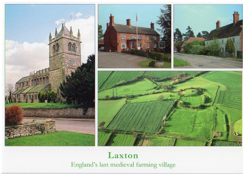
Laxton castle is a large and well preserved motte and bailey castle and is the
best surviving example in Nottinghamshire. It is associated with a wide range
of features connected with the medieval and post-medieval manor of Laxton and
has important historical associations, being a castle of the Everinghams, the
hereditary keepers of Sherwood Forest.
Source: Historic England
Books and journals
History of the Kings Works: Volume 2, (1963), 979-80
The Victoria History of the County of Nottinghamshire: Volume I, (1906), 306-7
'Archaeological Journal' in Archaeological Journal: Volume 38, , Vol. 38, (1881), 427
Other
1585/11-19,24; 1631/2, Riley, DN,
DW 041, St Joseph J K, DW 041,
PRN 04158b ref 4, PRN 04148b ref 4, (1974)
Samuels J R, AM107, (1985)
Title: Parish Map of Laxton
Source Date: 1635
Author:
Publisher:
Surveyor:
Source: Historic England
Other nearby scheduled monuments