Approximate Location Map
Large Map »
This site is entirely user-supported. See how you can help.
If Google Street View is available, the image is from the best available vantage point looking, if possible, towards the location of the monument. Where it is not available, the satellite view is shown instead.
Latitude: 54.3002 / 54°18'0"N
Longitude: -0.7968 / 0°47'48"W
OS Eastings: 478400.849769
OS Northings: 490062.547466
OS Grid: SE784900
Mapcode National: GBR QLWQ.98
Mapcode Global: WHF9P.Q5SR
Entry Name: Cawthorn Roman forts and camp including a section of medieval trackway known as the Portergate
Scheduled Date: 25 January 1960
Last Amended: 8 February 1994
Source: Historic England
Source ID: 1007988
English Heritage Legacy ID: 24436
County: North Yorkshire
Civil Parish: Pickering
Traditional County: Yorkshire
Lieutenancy Area (Ceremonial County): North Yorkshire
Church of England Parish: Cropton St Gregory
Church of England Diocese: York
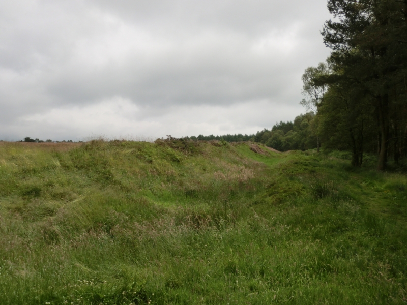
The monument includes the remains of two Roman forts, one of which has an
attached annexe, a Roman camp and a section of medieval trackway. It is
situated on the crest of a gentle south-facing slope at the northern rim of
the Vale of Pickering and immediately south of a steep slope known as Cawthorn
Banks. The whole complex is visible as a series of well preserved earthworks.
Three major elements can be identified: a camp of unusual polygonal design
overlain by a later fort which is probably datable to the late first century
AD and, to the east, a simple fort with an eastern annexe. The westernmost
fort is typically square in shape with rounded corners and measures 175m
across overall. It is orientated north-east by south-west. The defences
include a double bank and external ditch with a counterscarp bank formed from
the material upcast from the ditch. The main rampart banks are, together, 20m
wide and up to 1.5m high. The ditch is 2m wide and the counterscarp bank is
2.5m wide. There is no counterscarp bank visible on the south-western section
of rampart. There are entrances placed centrally in all sides except the north
where it is too close to the adjacent steep slope for an entrance here to be
practicable. The entrances were defended by an external ditch crossed by an
access causeway. Internally, large wooden gates would have protected the gap
in the ramparts. The south-eastern corner of the fort overlies the north-west
shoulder of the neighbouring polygonal camp, indicating that the fort was
built later.
The polygonal camp is particularly well preserved: only on the north-east side
are the earthwork defences in a poor state. The camp measures 260m north to
south by 95m overall at its widest point. The defences comprise a turf bank up
to 1.2m high above a ditch 0.8m deep and a counterscarp bank 3m wide and 0.3m
high. There are three gates along the east side each 8.5m wide. They are each
protected externally by a projecting rampart curving in front of the gate
and known as a clavicula. In the interior there are remains of turf built
structures, mostly sub-rectangular in plan and no more than 0.3m high. Some
are up to 6m across overall. These are located in the southern half and
north-western corner. The camp is crossed by a medieval packhorse track known
as the Portergate; this survives as a hollow way up to 0.8m deep but only 1m
wide at the base.
A second fort with an annexe lies 75m to the east. The main fort measures 150m
by 150m although it is slightly off square in shape and thus the western edge
is broadly parallel to the camp to the west and the northern edge follows the
top of the scarp slope. The impressive defences are 14m across and comprise a
single rampart bank, an outer ditch and a slight counterscarp bank. The
rampart is 1.7m high internally and stands 2.8m high above the bottom of the
ditch which is 1.6m deep. The defences on the north side are somewhat steeper
where in places they incorporate the edge of the scarp slope. The gateways on
the four sides are defended by both internal and external claviculae
apparently replacing the earlier inturned gateways. The annexe lying on the
east is approximately the same shape and size as the original fort although
the defences are not as robust. There are two gateways on the north and south
sides, both defended by claviculae. There are remains of internal structures
in both the fort and annexe; these comprise turf walls up to 0.3m high,
sub-rectangular in plan and concentrated in the south-eastern corner of the
annexe and in the northern part of the fort.
Partial archaeological excavations in the 1920s revealed that the defences
were constructed of turf and upcast material from the ditches. The eastern
fort at one time had substantial timberwork incorporated into the defences, in
particular along the west side. Here evidence was found of a series of
vertical posts 3m apart on the lip of the ditch, with a palisade trench some
1.8m behind. Deep holes for posts were also discovered along the rear of the
rampart on the south and east sides. The internal structures were found to be
built of turf; also uncovered were many pits and ovens. From the evidence
available the forts are known to have been occupied in several phases with the
bulk of the construction work occurring in the early first century AD.
Although the few archaeological finds from the excavations have not been dated
any later than AD 120, the structural evidence indicates a far longer span of
occupation.
In earlier studies this group of sites was interpreted as a group of training
and practice camps, not permanently occupied, and constructed largely to meet
the needs of Roman military exercises. Recent re-evaluation of the evidence
suggests that permanent occupation of the main forts is more likely, these
sites fitting into the wide network of permanently occupied and garrisoned
forts established to maintain control over the north of England.
Excluded from the scheduling are all National Park signs, fences, bridges and
surfaces of made-up paths, although the ground beneath all these features is
included.
MAP EXTRACT
The site of the monument is shown on the attached map extract.
Source: Historic England
Roman forts are straight sided rectangular enclosures with rounded corners,
defined by a single rampart of turf, puddled clay or earth, and with one or
more outer ditches. They contained a variety of buildings and other components
in accordance with their purpose as permanent bases for auxiliary units.
Construction of Roman forts began shortly after the Roman invasion of AD 43
and continued until the fourth century, with the most intensive period of
construction between the mid-first and mid-second centuries. The duration of
use of individual examples extended in some cases over several centuries. The
earliest forts were constructed with timber breastworks and wall walks on the
rampart, with timber gateways and towers at points around it. From the
beginning of the second century, however, there was a gradual replacement of
timber with stone. A separately defined annexe comprising an enclosed area
slightly smaller than the fort may be located outside the fort. These were
used for a variety of purposes including storage and accommodation of troops
and convoys during transit.
Roman camps are usually rectangular or sub-rectangular enclosures, constructed
by soldiers either as campaign or practice camps. Most campaign camps were
only temporary overnight bases but some were used for much longer periods.
They were bounded by a single earthen rampart and outer ditch with entrances
often protected by additional defensive outworks. Both Roman forts and camps
are rare nationally and are extremely rare south of the Severn-Trent line. As
such, and as belonging to a small group of Roman military monuments which are
important in representing army strategy and therefore government policy, forts
are of particular significance to our understanding of the period. For this
reason all Roman forts with significant archaeological potential are
considered to be nationally important.
The complex of remains at Cawthorn is rare and unusual both in the diversity
of individual elements and the high level of survival. Individually each of
the forts and the camp are well preserved and retain considerable detail about
their construction and form. Together the group provides a rare insight into
the historical development of an extensive military complex. Partial
excavation has demonstrated a high level of survival of archaeological remains
across the whole site. The camp is particularly unusual as it departs from the
normal regular square or rectangular shape and is in this case an elongated
hexagon. Study of the whole complex will contribute to the understanding of
the history of the Roman conquest and occupation of northern England.
Source: Historic England
Books and journals
Richmond, I A, 'Archeol J' in The 4 Roman Camps at Cawthorn in the North Riding of Yorkshire, , Vol. 89, (1932), 17-78
Richmond, I A, 'Archeol J' in The 4 Roman Camps at Cawthorn in the North Riding of Yorkshire, , Vol. 89, (1932), 17-78
Richmond, I A, 'Archeol J' in The 4 Roman Camps at Cawthorn in the North Riding of Yorkshire, , Vol. 89, (1932), 17078
Other
Draft survey report, Survey Cawthorn Camps, (1993)
Source: Historic England
Other nearby scheduled monuments