Approximate Location Map
Large Map »
This site is entirely user-supported. See how you can help.
If Google Street View is available, the image is from the best available vantage point looking, if possible, towards the location of the monument. Where it is not available, the satellite view is shown instead.
Latitude: 55.0111 / 55°0'39"N
Longitude: -2.3326 / 2°19'57"W
OS Eastings: 378825.040859
OS Northings: 568551.058838
OS Grid: NY788685
Mapcode National: GBR DB4H.SG
Mapcode Global: WH90Y.49HS
Entry Name: Housesteads fort, section of Wall and vallum between the field boundary west of milecastle 36 and the field boundary west of turret 37a in wall miles 36 and 37
Scheduled Date: 12 December 1928
Last Amended: 20 August 1998
Source: Historic England
Source ID: 1018585
English Heritage Legacy ID: 26059
County: Northumberland
Civil Parish: Bardon Mill
Traditional County: Northumberland
Lieutenancy Area (Ceremonial County): Northumberland
Church of England Parish: Beltingham with Henshaw
Church of England Diocese: Newcastle
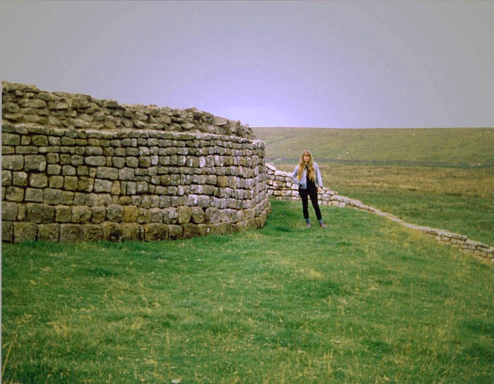
The monument includes Housesteads Roman fort and the section of Hadrian's Wall
and vallum and their associated features between the field boundary west of
milecastle 36 in the east and the field boundary west of turret 37a in the
west. This section occupies the crest and down slope of the escarpment,
defined to the north by Housesteads Crags and Cuddy's Crags and to the south
by the B6318 road.
Throughout most of this section Hadrian's Wall survives as an upstanding
feature. To the east of the fort a 320m section of the Wall is consolidated
and in the care of the Secretary of State. Within this stretch of consolidated
Wall there is a gateway, 3.7m wide, at the low point of the Knag Burn.
Possibly used by civil rather than military traffic, it consists of a single
passage flanked by guard chambers on either side. Pivot holes at back and
front show that there were two sets of doors. Between milecastle 36 and the
stretch of consolidated Wall, the Wall survives as a turf-covered mound
overlain on its north face by a modern field wall made from reused Roman
masonry. West of Housesteads to Rapishaw Gap the well-preserved remains of the
Wall have been consolidated. At Rapishaw Gap itself the Wall has been mostly
robbed out and a modern field wall overlies its south face. Beyond Rapishaw
Gap the Wall again survives as a consolidated upstanding feature. The wall
ditch was only constructed in the short gaps between the steep crags. On Clew
Hill the 35m section of ditch is up to 13m wide and 2m deep with tumbled Roman
masonry from the Wall in its base. Between Housesteads Crags and Cuddy's Crags
the ditch is visible though it is prone to silting and water-logging. Possible
remains of the ditch upcast, known as the `glacis', survives to the north of
the ditch as an amorphous spread of material covered by turf. At Rapishaw Gap
the ditch is heavily silted and overgrown with rushes, though it is still
visible to a depth of 1.3m. A modern trackway truncates the west end of this
ditch.
To the north east of Housesteads fort, and at the foot of the crags on which
the Wall is located, a number of medieval shielings have been identified.
These were used seasonally by shepherds controlling summer grazing on open
lands to the north. Additionally a linear earthwork, identified as a
prehistoric field boundary has been identified as well as Roman quarries. Two
circular earthworks, one known as the Fairy Stones, may be of prehistoric or
medieval date, although their function is not yet fully understood.
Milecastle 37 is situated on the crest of Housesteads Crags with extensive
views to the north and south. It is visible as an upstanding structure which
has been partly reconstructed and consolidated. The walls have a maximum
height of 2.2m internally and the single barrack block in the east half
survives to 1m in height. The milecastle was partly excavated between 1988 and
1989 by Crow when it was shown that the north gateway of this milecastle had
been deliberately blocked and then later partly demolished.
Turret 36a, located in 1911, occupies the crest of Kennel Crags. It is
visible as an irregular turf-covered platform measuring 17m north east by 6m
south west, and up to 1.1m high. No internal features are visible and it is
partly overlain by stone which has tumbled onto it from the adjacent Wall.
Excavations during 1946 showed that the turret had narrow walls and a door in
the east side.
Turret 36b was built before Housesteads fort, occupying part of the crest of
Housesteads Crags later overlain by the fort. The foundation courses of the
turret have been exposed by excavations within Housesteads fort. It survives
as an upstanding structure which has been consolidated and is in the care of
the Secretary of State as part of the fort.
Turret 37a was located on the crest of the scarp on the west side of Rapishaw
Gap. It survives as a buried feature beneath a turf cover. The turret was
deliberately demolished in an early phase and the Wall was rebuilt across the
site.
The Roman road known as the Military Way, which ran along the corridor between
the Wall and the vallum linking the turrets, milecastles and forts, survives
as a turf-covered linear mound throughout most of this section. West of
Housesteads Plantation the mound is well-preserved, up to 6.6m wide in places.
East of Housesteads Plantation the mound is 4m wide and 0.8m high on its south
side. The Military Way crosses the Knag Burn by a double dog-leg and enters
the east gate of the fort between the buildings of the extra mural settlement.
West of the fort the Military Way is visible as a linear mound with an often
indistinct north side. It averages between 3.3m and 6m in width. The south
side is revetted by a line of boulders up to 0.6m high. The road is turf-
covered with some cobbling visible in places. The approach to the west gate of
the fort is blocked by two or three banks which seem to be late defences of
the fourth century AD. Branch roads leading from the Military Way proper to
turret 36a, milecastle 37 and turret 37a are visible in places as slight level
mounds. Elsewhere their course is indicated by differing vegetation marks seen
in grass colour. This differentiation in vegetation cover reflects differing
growing conditions on the compacted road surface.
An earlier Roman road runs from the north side of the vallum south of King's
Hill westwards towards Housesteads where it is overlain by the Military Way at
NY7925 6997. It survives as a turf-covered linear mound up to 6.5m wide and
0.9m high. Some metalling is visible through the turf.
East of the fort the vallum survives as an upstanding earthwork. The north and
south mounds have been reduced and spread by agriculture, though the ditch is
up to 1.5m deep. West of the Knag Burn there is little surface trace of the
vallum as it was levelled when the settlement outside the fort developed and
was built over it. To the west of the fort the remains of the vallum are not
obvious. However, parallel cultivation terraces and occasional banks up to 1m
high denote its course. The ditch is completely silted up in this stretch.
The Roman fort at Housesteads, known to the Romans as Vercovicium, occupies
the prominent crest of the Whin Sill escarpment to the west of the Knag Burn.
It commands wide views to the north and south, being one of the most dramatic
and best preserved Roman sites in Britain. It is unusual among the Wall forts
for having an east-west orientation rather than a north-south one. This is due
to the constraints imposed by the topography. The fort covers an area of
approximately 2ha and accommodated a cohort between 800 and 1,000 strong,
being later reinforced by a cavalry unit. Its remains survive well as
upstanding masonry and earthworks and buried features. The walls and gateways
of the fort are exposed and consolidated. A number of the interior buildings
are also exposed and consolidated including the headquarters building, the
commanding officer's house, a hospital, granaries, barracks, workshops and a
latrine. The fort is in the care of the Secretary of State. The fort was added
to the Wall after the broad wall foundations and turret 36b were built, but
before the narrow wall (which was eventually constructed on the broad wall
foundations) was constructed up to the fort. The earliest activity on the site
is evidenced by a Bronze Age pot found beneath one of the barracks, which had
probably come from a ridge top burial cairn. Post-Roman activity on the fort
site is evidenced by a bastle house which was built partly over the west tower
of the south gateway. There has been a history of excavations on the fort from
1822 up to 1988.
The civil settlement outside the fort, usually referred to as a vicus, is very
extensive stretching for at least 200m south of the fort. It also clustered
around the east and west sides of the fort. In its initial phase the vicus was
situated to the south of the vallum. However, by the third century AD at the
latest the vallum was levelled and the vicus was moved up the hill and
constructed immediately adjacent to the fort. To the south of the fort over 20
buildings were excavated during the 1930s, although only six remain on view as
upstanding buildings with consolidated stone walls. They are believed to be
the foundations of a group of shops and/or taverns. Outside the fort's east
gate small robber trenches demarcate the ground plans of some of the vicus
buildings. On the west side of the fort, north of the Military Way, there is a
series of mounds, up to 0.8m high, forming small rectangular paddocks. These
may have accommodated the horses associated with the cavalry unit known to
have been stationed at the fort in its later phases. Aerial photographs show
that the remains of the vicus around Housesteads covered an area at least as
large as that of the fort itself. Excavation has shown that the settlement
dates, in its most developed form, to the third and fourth centuries AD. An
inscription indicates that this vicus had its own local government.
Beyond the vicus to the south and west there is a series of cultivation
terraces running along the contours in a roughly east-west direction. They
survive as upstanding earthworks and can be seen to directly overlie the
vallum. These terraces are themselves overlain in parts by strip fields and
early ridge and furrow cultivation. On the basis of these relationships the
terraces are considered to be of Roman date and are probably associated with
the vicus settlement.
The Housesteads bath house was positioned to the east of the fort on a rock
shelf on the slope on the east side of the Knag Burn. Its disturbed remains
survive as turf-covered undulations. Investigations have shown that it was
heated by hypocausts, soot being found in the flues. Nearer the Wall is a
spring cased in Roman masonry, which probably supplied the baths with water.
The location of two cemeteries at Housesteads fort and vicus are known,
surviving as buried features below the turf cover. There is one cemetery
situated to the west of the fort, south of the Military Way. Another is known
to lie either side of Chapel Hill. To the south of Chapel Hill a number of
tombstones have been found including one commemorating a medical officer named
Anicius Ingenuus. In the low ground to the east of Chapel Hill human remains
have been found during drainage works. These finds suggest the cemetery around
Chapel Hill was extensive.
The remains of a temple to the Persian god Mithras is located beyond the west
end of Chapel Hill, close to where a spring flows. This half underground
temple was located in 1822. It survives as a series of turf-covered features,
some of which are visible as slight earthworks. Excavations in 1898 revealed a
long nave, flanked on either side by benches for the accommodation of
worshippers. Beyond this was the sanctuary which contained an elaborate relief
carving of Mithras surrounded by the zodiac, together with several altars and
statues to two lesser deities.
The remains of a temple to the Germanic god `Mars Thincsus' is located to the
north of Chapel Hill. A well found during excavation has been consolidated and
can be seen on the ground. The other remains survive as buried features.
Excavations during 1961 revealed the foundations of a circular shrine, 4m in
diameter. Pottery recovered from the interior dated the structure to the third
century AD. Other finds included an elaborately carved arched door head and
inscribed stones dedicated to `Mars Thincsus'. The shrine was found to overlie
part of the vicus settlement when it was situated to the south of the vallum.
A series of temples are known from building inscriptions to have been located
on Chapel Hill itself. Their remains survive as buried features. Several
altars have been found here dedicated to Jupiter and the Spirit of the Deified
Emperors, indicating that the official state cult was practised here.
A Roman lime kiln is located on the west side of the Knag Burn near to the
bath house. It was located and excavated during 1909 by Simpson. Its remains
survive as buried features. Pottery from the interior dated the structure
from the late third to the mid-fourth century AD.
A bastle house was built over the remains of the east side of the south
gateway of the fort in the 16th century. It survives as an upstanding stone
feature, rebuilt with Roman masonry and projects out to the south of the fort.
Bastle houses are defended farmhouses, usually with an upstairs doorway and no
windows in the lower storey. The upper stories were lived in while the lower
one was used as an animal byre. Bastle houses often occur in small groups and
are characteristic of the 16th and early 17th century, being a response to the
cattle raiding exploits of the border reivers.
All buildings, walls, except those constructed directly on the line of
Hadrian's Wall, English Heritage fixtures and fittings, timber steps, gates
and stiles, and the road and the car park surfaces, are excluded from the
scheduling although the ground beneath all these features is included.
MAP EXTRACT
The site of the monument is shown on the attached map extract.
Source: Historic England
Hadrian's Wall marks one of the frontiers of the Roman Empire. The
international importance of the surviving remains has been recognised through
designation as a World Heritage Site.
The military importance of the Tyne-Solway route across the Pennines was
recognised by the Romans during their early campaigns through northern England
and into Scotland in the second half of the first century AD. At this time a
military road, the Stanegate, was constructed along with a series of forts.
Subsequently the Romans largely withdrew from Scotland and there is evidence
that the Tyne-Solway route was being recognised as a frontier by the start of
the second century AD. This position was consolidated in the early second
century by the construction of a substantial frontier work, Hadrian's Wall,
under the orders of the Emperor Hadrian. Hadrian's successor, Antoninus Pius,
subsequently attempted to establish the boundary further north, between the
Clyde and the Firth of Forth, but by c.AD 160 growing unrest amongst the
native populations of northern Britain and pressures elsewhere in the Empire
caused a retraction back to the Hadrianic line. Hadrian's Wall was then the
frontier of the Roman Empire in Britain until c.AD 400 when the Roman armies
withdrew from Britain.
Stretching over 70 miles from coast to coast, Hadrian's Wall was a continuous
barrier built of stone in the east and, initially, of turf in the west. The
stone wall was originally designed to be ten Roman feet wide and sections of
this width are termed broad wall. A change of plan shortly after construction
began led to a reduction in the width of the Wall to eight Roman feet, such
sections being termed narrow wall. Today, stretches of both wall types
survive, including some sections of narrow wall built on broad wall
foundations. For most of its length a substantial ditch on the northern side
provided additional defence. Where the Wall crossed rivers, bridges were
constructed to carry it across. Construction of the Wall was organised and
executed by legionary soldiers. From the beginning the barrier was planned to
comprise more than just a curtain wall. At regularly spaced intervals of about
a mile along its length lay small walled fortlets known as milecastles. These
were attached to the southern side of the Wall and most had a gateway through
the Wall to the north. Hence they controlled crossing points through the Wall
as well as affording space for a small stable garrison. Between the
milecastles were two equally spaced towers known as turrets. Together the
milecastles and turrets provided bases from which the curtain wall could be
watched and patrolled. Both the turrets and milecastles are thought to have
been higher than the Wall itself to provide suitable observation points. It is
often assumed that a platform existed on the Wall so that troops could
actually patrol along the wall top; it is however far from certain that this
was the case.
At the western end of the Wall a system of towers, small fortlets and palisade
fences extended the frontier system another 30 miles or so down the Cumbrian
coast and helped control shipping moving across the estuary of the Solway
Firth.
As originally planned, and apart from whatever space there was in the
milecastles, provision for the accommodation of garrison troops manning the
Wall was left with the line of forts which already lay along the Stanegate. At
some point a fundamental change of plan took place and forts were constructed
along the line of the Wall itself. There are now known to have been 16 forts
either attached to the Wall or in close association with it. Some overlay
earlier features such as turrets or milecastles. At this stage another linear
element, the vallum, was also added to the defensive system to the south of
the Wall. This was a broad flat-bottomed ditch flanked by a pair of linear
banks. It shadows the course of the Wall for almost all its length, sometimes
lying very close to it but sometimes up to a kilometre away from it. The
vallum's main function was to act as a barrier to restrict access to the Wall
from the south. It also had a function in linking the forts along the Wall
with a method of lateral communication. When the forts were placed along the
wall line no provision was made for a road to link them. This situation was
clearly found impracticable and a metalled track was therefore provided in
places along the vallum between the north mound and the ditch.
Later, after the withdrawal back to the Hadrianic line from the Antonine Wall,
various refurbishments were made throughout the frontier line. At this stage a
new linear feature was added: the `Military Way'. This was a road linking all
elements of the Wall defence, running from fort to fort within the area
bounded by the Wall and the vallum.
Throughout its long history the Wall was not always well maintained. It was
often neglected and sometimes overrun, but it remained in use until the late
fourth century when a weak and divided Roman Empire finally withdrew its
armies from the Wall and Britain.
It now survives in various states of preservation. In places, especially in
the central section, the Stone Wall still remains several courses high and the
attached forts, turrets and milecastles are also clearly indentifiable.
Earthwork features such as the ditch, vallum and Military Way also survive
well in places. Elsewhere the Stone Wall has been virtually robbed out and
only its foundations survive beneath the present ground surface. Similarly,
stretches of the earthwork remains, including sections of the Turf Wall, have
been levelled or infilled and now only survive as buried features. Although
some sections of the frontier system no longer survive visibly, sufficient
evidence does exist for its position to be fairly accurately identified
throughout most of its length.
Housesteads Roman fort and its associated features in the section of Hadrian's
Wall between the field boundary west of milecastle 36 and the field boundary
west of turret 37a survives well as a series of upstanding and buried remains.
Significant information on the development of the frontier system over time
will be preserved. Housesteads is probably the best preserved Roman fort on
display in England. It has produced many significant archaeological finds
including quantities of statuary, altars, inscriptions, pottery and small
finds. The silted ditches will contain environmental evidence which will allow
the character of the surrounding area in the Roman period to be better
understood.
Source: Historic England
Books and journals
Birley, E, Research on Hadrian's Wall, (1961), 182-3
Bruce, J C, Handbook to the Roman wall, (1863), 153-154
Bruce, J C, Handbook to the Roman wall, (1863), 151-2
Crow, J G, Housesteads Roman Fort, (1989)
Crow, J G, Housesteads Roman Fort, (1989), 16-17
Crow, J G, Housesteads Roman Fort, (1989), 30-33
Simpson, F G, Watermills and Military Works on Hadrian's Wall: Excavations..., (1977), 152-59
Stevens, C E, 'Journal of Roman Studies' in Roman Britain in 1946, , Vol. 37, (1947), 168
Source: Historic England
Other nearby scheduled monuments