Approximate Location Map
Large Map »
This site is entirely user-supported. See how you can help.
If Google Street View is available, the image is from the best available vantage point looking, if possible, towards the location of the monument. Where it is not available, the satellite view is shown instead.
Latitude: 51.2639 / 51°15'50"N
Longitude: -2.1426 / 2°8'33"W
OS Eastings: 390149.315565
OS Northings: 151646.92788
OS Grid: ST901516
Mapcode National: GBR 1TG.R3Y
Mapcode Global: VH979.TH5G
Entry Name: Bratton Camp Iron Age hillfort, the Westbury White Horse, barrows and trackways on Bratton Down
Scheduled Date: 14 May 1934
Last Amended: 22 January 1996
Source: Historic England
Source ID: 1013399
English Heritage Legacy ID: 26708
County: Wiltshire
Civil Parish: Bratton
Traditional County: Wiltshire
Lieutenancy Area (Ceremonial County): Wiltshire
Church of England Parish: Bratton St James the Great
Church of England Diocese: Salisbury
The monument includes Bratton Camp Iron Age hillfort, together with the 18th
century Westbury White Horse, a Neolithic long barrow, Bronze Age round
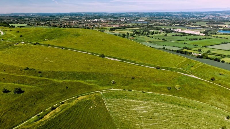
barrows and a group of sunken trackways. The monument lies at a height of
225m OD in a prominent position overlooking Westbury at the edge of the
Salisbury Plain chalk escarpment.
The Iron Age hillfort is multivallate, possessing two circuits of ditch and
bank which together enclose a pentagonal area of approximately 9.3ha. The
hillfort, which has one clearly defined entrance on the south side, measures
internally 430m east-west by 120m at the west end and 300m at the east end.
The short west side and the long north side occupy the crest of steep
escarpment slopes and the ditches are stepped one above the other, the
rampart slopes rising 5m to 6m above the base of the ditches. The defences
here span a total width of approximately 30m.
The south side of the hillfort and the southern half of the east side cross
Bratton Down and here the twin ramparts are of roughly equal height and again
approximately 30m in total width. The northern half of the east side crosses
the head of a re-entrant valley where the outer rampart and ditch have been
largely destroyed by quarrying or landslips and the construction of a farm
track. The short north east side straddles a narrow steep-sided ridge up
which runs the Port Way. This passes through a further and possibly original
entrance, at which point the two ramparts have separated to form a small
annexe, the outer ditch of which has, in places, been removed by quarrying.
Quarrying has, in the past, also taken place within parts of the interior of
the fort.
Excavations in the 18th century by Whitaker in the interior of the
hillfort produced quernstones and a collection of large pebbles suggested as
possible sling stones.
Abutting the western rampart of the hillfort is the Westbury White Horse, the
first documentary record of which is in 1742. The original horse, according
to a drawing published in 1772, faced south, but was destroyed in 1778 and
replaced by the present one, facing north. This horse, which is cut into a
very steep slope immediately below the western defences of the fort, is
naturalistic in form and has, since 1936, been redefined using concrete.
The long barrow, which lies within the interior of the fort, is a substantial
mound 73m long and, at its widest point, over 17m across. It is approximately
3m high at the highest (eastern) end, the height reducing to a little over 2m
at the west end. The barrow has been partially excavated on at least three
occasions, initially in the 18th century by Whitaker without recorded results.
In the early 19th century two investigations by Cunnington revealed first
pottery, animal bones, and a bead, and subsequently three skeletons. In the
mid 19th century further investigations were carried out by Thurnham who found
a primary cremation platform for one or two adults.
The remains of two Bronze Age round barrows are recorded as lying within the
defences of the hillfort. The most pronounced, a mound 16m in diameter and
1.2m high, with a clearly defined central hollow and traces of a surrounding
ditch, lies between the inner rampart and the out-turned outer rampart to the
east of the southern entrance. This was investigated by Cunnington in 1802,
without recorded result. The second example, described as a small flat barrow
encircled by a ditch, was also apparently excavated in 1802 without recorded
result and can no longer be located on the ground.
A complex system of sunken trackways lies parallel to the Port Way along the
narrow steep-sided ridge to the north east of the hillfort. Although most
likely to be of medieval or later date they may relate to the possible
hillfort entrance at this point. Their complexity, together with that of the
quarrying adjacent to the hillfort ramparts, may mask additional elements of
the hillfort itself.
Excluded from the scheduling are all roads, areas of hard standing, fences,
posts, gates, steps, stiles and drinking troughs, although the ground beneath
these features is included.
The monument is in the care of the Secretary of State.
MAP EXTRACT
The site of the monument is shown on the attached map extract.
It includes a 2 metre boundary around the archaeological features,
considered to be essential for the monument's support and preservation.
Source: Historic England
Large multivallate hillforts are defined as fortified enclosures of between
5ha and 85ha in area, located on hills and defined by two or more lines of
concentric earthworks set at intervals of up to 15m. They date to the Iron
Age period, most having been constructed and used between the sixth century BC
and the mid-first century AD. They are generally regarded as centres of
permanent occupation, defended in response to increasing warfare, a reflection
of the power struggle between competing elites.
Earthworks usually consist of a rampart and ditch, although some only have
ramparts. Access to the interior is generally provided by two entrances
although examples with one and more than two have been noted. These may
comprise a single gap in the rampart, inturned or offset ramparts,
oblique approaches, guardrooms or outworks. Internal features generally
include evidence for intensive occupation, often in the form of oval or
circular houses. These display variations in size and are often clustered,
for example, along streets. Four- and six-post structures, interpreted as
raised granaries, also occur widely while a few sites appear to contain
evidence for temples. Other features associated with settlement include
platforms, paved areas, pits, gullies, fencelines, hearths and ovens.
Additional evidence, in the form of artefacts, suggests that industrial
activity such as bronze- and iron-working as well as pottery manufacture
occurred on many sites.
Large multivallate hillforts are rare with around 50 examples recorded
nationally. These occur mostly in two concentrations, in Wessex and the Welsh
Marches, although scattered examples occur elsewhere.
In view of the rarity of large multivallate hillforts and their importance in
understanding the nature of social organisation within the Iron Age period,
all examples with surviving archaeological potential are believed to be of
national importance.
Bratton Camp is a well preserved example of its class. It survives as
extensive and substantial earthworks within an area of public access and
consequently has value as a public amenity. The fort, although the most
visually impressive element of the hilltop, was preceded by funerary monuments
of both Neolithic and Bronze Age date; the Neolithic long barrow is one
of only 500 examples recorded nationally. A complex of substantial hollow
trackways, probably of medieval or later date approaches the hillfort from the
north east where in the 18th century, the slopes of the hill were utilised for
the construction of the Westbury White Horse, a major landmark feature
providing a visual identity to this particular area of Wessex.
Together the diverse elements of this monument provide evidence for the use of
Bratton Down for funerary, defensive and display purposes over a period of
five millennia.
Source: Historic England
Books and journals
Camden, W, Britannia, (1772)
Colt Hoare, R, The Ancient History of Wiltshire: Volume I, (1812), 55-56
Colt Hoare, R, The Ancient History of Wiltshire: Volume I, (1812), f. p 55
Colt Hoare, R, The Ancient History of Wiltshire: Volume I, (1812), f. p 55
Wise, F, Further Observations upon the White Horse and other Antiquities, (1742)
Meyrick, O, 'Wiltshire Archaeological and Natural History Magazine' in Sir Richard Colt Hoare and William Cunnington, (1948), 216
Meyrick, O, 'Wiltshire Archaeological and Natural History Magazine' in Sir Richard Colt Hoare and William Cunnington, (1948), 216
Robinson, P, 'Wiltshire Archaeological and Natural History Magazine Bulletin' in The exacavations of Jeffery Whitaker at Bratton camp, , Vol. 25, (1979), 13-13
Robinson, P, 'Wiltshire Archaeological and Natural History Magazine Bulletin' in The exacavations of Jeffery Whitaker at Bratton camp, , Vol. 25, (1979), 11-13
Thurnham, , 'Archaeologia' in On Ancient British Barrows etc (Part 1: Long barrows), , Vol. 42, (1869), 192-193
Source: Historic England
Other nearby scheduled monuments