Approximate Location Map
Large Map »
This site is entirely user-supported. See how you can help.
If Google Street View is available, the image is from the best available vantage point looking, if possible, towards the location of the monument. Where it is not available, the satellite view is shown instead.
Latitude: 53.7987 / 53°47'55"N
Longitude: -2.6955 / 2°41'43"W
OS Eastings: 354283.765857
OS Northings: 433826.455378
OS Grid: SD542338
Mapcode National: GBR TBJ.02
Mapcode Global: WH85F.KSM6
Entry Name: Cromwell's Mound Civil War fieldwork
Scheduled Date: 26 November 1969
Last Amended: 2 July 1999
Source: Historic England
Source ID: 1016551
English Heritage Legacy ID: 27849
County: Lancashire
Electoral Ward/Division: Sharoe Green
Built-Up Area: Fulwood
Traditional County: Lancashire
Lieutenancy Area (Ceremonial County): Lancashire
Church of England Parish: Broughton St John The Baptist
Church of England Diocese: Blackburn
The monument includes Cromwell's Mound, a feature traditionally associated
with the Battle of Preston, fought on the 17th August 1648. It is interpreted
as a fieldwork, that is, a gun emplacement or earthwork used to provide
temporary
protection for infantry troops, and is located in a shallow valley through
which Moss Leach Brook flows approximately 350m north east of the medieval
moated site of Broughton Tower. Its location adjacent to the brook suggests
the mound may originally have been a dam associated with the water management
system of Broughton Tower. The mound takes the form of a `T'-shaped earthwork
measuring approximately 37m long by 8m-12m wide and up to 1.9m high with its
longest side orientated north west-south east. The tail of the `T' shape is
formed by an embankment sloping down south westwards from the highest point of
the mound.
The Battle of Preston was the largest and final battle of the Second Civil
War. It was fought between royalist supporters of Charles I aided by a
Scottish army 20,000 strong led by the Duke of Hamilton, and parliament's New
Model Army under the command of Oliver Cromwell. The subsequent defeat for the
royalist cause led to the execution of the king and the declaration of a
republic. Despite a lack of documentary evidence, tradition has it that
Broughton Tower was stormed by a band of Cromwell's troops during the battle
and that Cromwell's Mound was used during this action. Frequent finds of lead
musket balls and sling shot in the fields between the mound and Broughton
Tower have been offered as evidence to justify this tradition. It has also
been suggested that the mound, which lay to the right of the main flank of
parliamentarian forces, may have provided Cromwell with his first vantage
point from which to view the battlefield and judge the disposition of royalist
and Scottish troops during the initial stages of the battle.
All fence posts are excluded from the scheduling, although the ground beneath
these features is included.
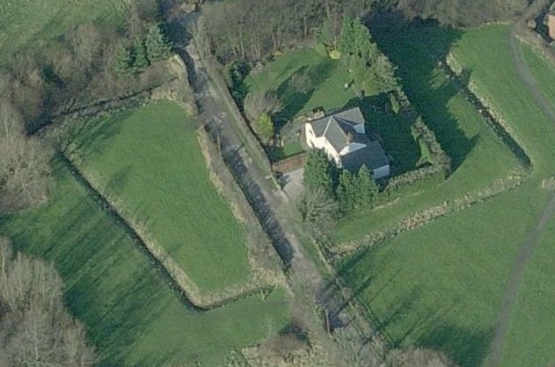
MAP EXTRACT
The site of the monument is shown on the attached map extract.
Source: Historic England
English Civil War fieldworks are earthworks which were raised during military
operations between 1642 and 1645 to provide temporary protection for infantry
or to act as gun emplacements. The earthworks, which may have been reinforced
with revetting and palisades, consisted of banks and ditches and varied in
complexity from simple breastworks to complex systems of banks and inter-
connected trenches. They can be recognised today as surviving earthworks or as
crop- or soil-marks on aerial photographs. The circumstances and cost of their
construction may be referred to in contemporary historical documents.
Fieldworks are recorded widely throughout England with concentrations in the
main areas of campaigning. Those with a defensive function were often sited to
protect settlements or their approaches. Those with an offensive function were
designed to dominate defensive positions and to contain the besieged areas.
There are some 150 surviving examples of fieldworks recorded nationally. All
examples which survive well and/or represent particular forms of construction
are identified as nationally important.
Cromwell's Mound Civil War fieldwork remains in good condition and is a rare
surviving example of a monument of this class which is associated with the
Second Civil War of 1648.
Source: Historic England
Books and journals
Bull, S, Seed, M, Bloody Preston: The Battle of Preston, 1648, (1998), 1-3, 66
Other
FMW Report, Capstick, B, Cromwell's Mound, Earthwork 1/4 mile NNE of Broughton Tower, (1988)
Neil, N., Excavations at Broughton Tower, 1990, Lancaster University Arch Unit report
SMR No. 110, Lancashire SMR, Cromwell's Mound,
Source: Historic England
Other nearby scheduled monuments