Approximate Location Map
Large Map »
This site is entirely user-supported. See how you can help.
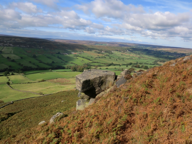
If Google Street View is available, the image is from the best available vantage point looking, if possible, towards the location of the monument. Where it is not available, the satellite view is shown instead.
Latitude: 54.4473 / 54°26'50"N
Longitude: -0.9083 / 0°54'29"W
OS Eastings: 470888.101515
OS Northings: 506315.746414
OS Grid: NZ708063
Mapcode National: GBR QK30.4J
Mapcode Global: WHF8W.0GRZ
Entry Name: Danby Rigg cairnfields, cross dykes, funerary monuments and associated features
Scheduled Date: 5 January 1971
Last Amended: 4 February 1999
Source: Historic England
Source ID: 1018782
English Heritage Legacy ID: 30196
County: North Yorkshire
Civil Parish: Danby
Traditional County: Yorkshire
Lieutenancy Area (Ceremonial County): North Yorkshire
Church of England Parish: Danby with Castleton and Commondale
Church of England Diocese: York
The monument includes the buried and earthwork remains of a predominantly
Bronze Age landscape of farming and funerary activity occupying the northern
end of Danby Rigg, also known as Ainthorpe Rigg, a promontory extending
northwards from the main block of the North York Moors. The monument lies on
land which rises southwards from about 230m above sea level to a plateau at
300m, and is defined to east and west by steep slopes down to the dales on
either side.
The remains of prehistoric farming activity are very extensive with a large
number of stone clearance cairns across the rigg indicating two areas of field
systems of different designs, partly laid out with low stony banks defining
field boundaries. The funerary remains on the rigg include a round barrow
cemetery, six ring cairns, together with a number of other scattered round
barrows. Running across the spine of the rigg there are three linear features;
two cross dykes and one pit alignment, the southern of the two cross dykes
dating to the Viking period. The monument also includes a number of other
remains that originate after the Bronze Age, including a bloomery for smelting
iron and two paths marked by standing stones, which are thought to have been
constructed in the medieval period.
The archaeological features on Danby Rigg have been investigated by a number
of people over the years. Canon Atkinson partly excavated two ring cairns in
1863, Elgee made a sketch plan of the area in 1930, Lamplough part excavated
an enclosure along with two round barrows in 1955-58, and Aberg produced a
plan of the banks in the 1960s. Between 1985 and 1989 the rigg was surveyed
and subjected to a number of small-scale test excavations for a joint research
project by Durham University and the Polish Academy of Sciences. In 1993 the
pit alignment was surveyed in detail by the Royal Commission on the Historical
Monuments of England.
The monument is divided into two areas by the northernmost cross dyke which
runs ESE to WNW across the top of the rigg in line with Crossley Side and
North End Farms. To the north of this cross dyke there is an extensive
cairnfield containing in excess of 700 cairns typically 2m-4m in diameter and
up to 1m high. These are the result of stone clearance in the Bronze Age to
improve the land for farming. Some of the stone was also piled into low earth
and stone banks which generally run in straight lines, either across the rigg,
approximately east to west or along it, north to south. These banks, along
with lines of clearance cairns, form the remains of a regular aggregate field
system which probably originally incorporated fence and/or hedge lines. Some
of these cairns are larger, 5m-10m in diameter, and show signs of more careful
construction, being circular in plan and much more regular in appearance.
These are concentrated in the south western part of the area to the north of
the cross dyke where there is a group of around 30 mounds amongst a scatter of
smaller cairns. This is considered to be a round barrow cemetery, with the
mounds primarily functioning as burial mounds. Beyond this area there is a
scatter of other isolated round barrows, the largest of which lies on the
eastern edge of the plateau, 60m north of the cross dyke. This was excavated
in 1955 by Lamplough, who found the remains of a number of cremation burials
and other Bronze Age finds including parts of a copper alloy knife and four
pottery vessels. Just to the east of the main concentration of round barrows,
following a slightly curving line running north-south, there is a line of five
ring cairns. These are burial monuments formed by a stony ring bank 11m-13m in
diameter. The northernmost, which incorporates a standing stone, was excavated
by Atkinson in 1863 and re-excavated in 1986-89. At the centre of the ring
cairn there was a 1.7m by 1.1m pit containing two Bronze Age cremation urns
and a large quantity of burnt bone. The stones of the ring bank were uncovered
but not removed during the excavation and further archaeological remains are
expected to survive underneath. All except the southernmost ring cairn are
spaced at fairly regular intervals centred 140m-150m apart, with the last one
90m south of its neighbour. A sixth ring cairn lies 70m WNW of the neighbour
of the southernmost cairn. This ring cairn, which is not on the same alignment
as the rest, occupies the skyline when viewed from the dale to the west. It is
larger than the others, 17m in diameter, and lies on the southern side of the
round barrow cemetery.
Aligned with the southern side of this ring cairn is a segmented embanked pit
alignment which runs in four sections across the rigg. Each section is formed
by two to three pairs of equally spaced pits with banks to the north and
south. Running roughly parallel with the pit alignment is the northern of the
two cross dykes. This is a low bank 2m-4m wide and up to 1m high which runs
across the rigg. It has an intermittent ditch on its southern side and a 70m
gap towards the middle of its length. At about the centre of this gap, which
is considered to be an original feature, is the southernmost of the line of
five ring cairns. The southern part of the monument falls to the south of this
cross dyke, and to the north of the second cross dyke, known as Double Dyke,
and three outlying cairns. Double Dyke and the outlying cairns form the
southern boundary of the monument. This area is very different in nature to
the northern part of the monument. Except within about 20m-30m of the two
cross dykes, there is a large quantity of uncleared surface stone. There are
clearance cairns, but these are much more infrequent than in the northern part
of the monument with only about 70-80 cairns, seven of which are over 4m in
diameter. The area also includes low stony banks, but these are generally
curving and, together with alignments of cairns, can be seen to form the
remains of an irregular aggregate field system in contrast to the more
rectangular fields of the regular aggregate field system to the north.
Approximately halfway between the two cross dykes there is an oval ring bank
which has been identified as the second ring cairn excavated by Atkinson in
1863. However it was excavated in 1956 by Lamplough, who found no evidence of
the central pit recorded in the previous century.
Instead it is now considered to be one of the enclosures of the field system.
The survey in the 1980s identified three features interpreted as hut circles
between this enclosure and the northern cross dyke. These are considered to be
stone footings of small buildings 4m-5m in diameter. Further dispersed
settlement remains are considered to have been obscured by a covering of peat
which is thought to have started developing on the rigg in the later
prehistoric period. Double Dyke forms the southern boundary of the monument
except on the eastern side of the plateau, where three cairns lying 20m-25m
beyond the cross dyke mark the southern boundary. The three cairns are
included in the scheduling. No other archaeological features are known on the
rigg to the south of Double Dyke apart from the three outlying cairns to the
south east of Double Dyke, until Pind Howe round barrow 1km further south.
Double Dyke is of a much larger scale than the cross dyke to the north. It is
in two principal straight sections that meet at a slight angle. The eastern
section is formed by a pair of banks, with a ditch in between, which runs ESE
to WNW for about 120m and includes a deliberate break towards its eastern end.
The western section has three parallel banks separated by ditches and runs
south east to north west for 200m. There is a gap between the two sections and
both terminate at right angles to the steep slopes to the east and west
respectively. A 2m wide trench was excavated through the triple banked part of
the cross dyke in 1986 which produced charcoal samples from the ditches. The
two northern ditches were radiocarbon dated to the early medieval period, and
the southern ditch to the 9th-10th century AD.
There are other features on the rigg that are considered to be later in date
than the predominantly Bronze Age landscape. Some 300m beyond the northern
cross dyke on the eastern side of the plateau there is a heap of iron slag
surrounded by shallow pits dug to extract iron ore-bearing stone. This area
also includes the buried remains of one or more bloomeries, small furnaces
for smelting iron which were used from the Iron Age through into the medieval
period. Crossing the rigg 20m to the north of the slag heap there is a wall
line that is very different in nature to the others in the field system. It is
built of orthostats, a single line of large boulders set on end, and extends
partly down the steep slope to the east. The rigg is also crossed by two
medieval footpaths marked by waymark stones which are typically set at 80m
intervals. Both start at Slate Hill at the head of Little Fryup Dale. Church
Way runs over the rigg to the church in Danby Dale, whilst Old Wives Stones
Way runs up onto the rigg and then down its spine to Ainthorpe, past the
northernmost ring cairn which incorporates the standing stone. The waymark
stones are of undressed stone and typically 0.2m-0.3m square, standing around
1.5m high.
Excluded from the scheduling are three grouse butts built into the southern
side of Double Dyke, and the modern timber waymark posts, although the ground
beneath these features is included.
MAP EXTRACT
The site of the monument is shown on the attached map extract.
Source: Historic England
Danby Rigg has long been recognised as a well-preserved prehistoric landscape
and has been the subject of a number of archaeological investigations over the
years. It is one of the most extensive and complex of such landscapes known on
the North York Moors, and retains valuable information about the early
exploitation of the upland areas. The monument retains a wide range of well-
preserved features, most of which are considered to be Bronze Age in date
(2000-700 BC), although some, notably Double Dyke, are later.
The cairnfield is the most extensive part of the monument. Prehistoric
exploitation of the relatively thin upland soils led to erosion and an
increasing amount of surface stone which was cleared into clearance cairns in
an attempt to increase the amount of land available for farming. Typically,
some of these cairns would have been used for cremation burials, and cairns
frequently outlined small plots or fields. On Danby Rigg there are two forms
of field system incorporated in the cairnfield. To the north of the central
cross dyke, a number of cairns form lines or are incorporated into straight
stony banks which make up a regular aggregate field system. This is
characterised by boundaries aligned on two main axes at right-angles to each
other. Excavations of similar sites have shown that they were often
supplemented by fences or hedges to form small rectangular plots. To the south
of the cross dyke, the banks and lines of cairns form sub-circular or
irregular plots which are characteristic of an irregular aggregate field
system. Examples of both arrangements of fields have been dated from the
Bronze Age into the Roman period. The two field systems on Danby Rigg are
considered to either demonstrate areas of differing exploitation, perhaps
permanent pasture in one area with mixed arable and grazing in the other, or
different periods of exploitation. The survival of these two field system
forms adjacent to one another heightens the national importance of Danby Rigg.
Few hut circles associated with field systems are known on the moors, where
most permanent Bronze Age settlement is considered to have been in the
adjacent dales, which has subsequently been obscured by later farming
activity, so the identification of three hut circles is also of significance.
Danby Rigg was also important in the Bronze Age for human burial, employing
both round barrows and ring cairns. The cemetery is considered to have
developed over a long period of time and will contain valuable information
about the range and development of burial practices in the Bronze Age. Ring
cairns, which are considered to be of Early to Middle Bronze Age in date, are
nationally much rarer than round barrows, and the group on Danby Rigg is thus
of especial importance.
The pit alignment is of a type identified in 1993 and is one of only four
examples known nationally, all of which lie within 15km of Danby Rigg. These
features are poorly understood, but are believed to be related to funerary
ritual as all are closely associated with burial mounds. Another
interpretation is that they formed a type of boundary marker similar to other
forms of pit alignments and the two cross dykes on the rigg. The northern
cross dyke, like most on the North York Moors and elsewhere nationally, is
considered to be Middle to Late Bronze Age and to have defined the boundary
between two differing areas of land use. The more substantial Double Dyke is
one of the very few archaeological remains on the North York Moors to be dated
to the Viking period, suggesting that some of the other remains on the rigg
may also be Dark Age in date which, because of their rarity, would be of
particular national importance. The iron slag heap marking the location of the
buried remains of one or more bloomeries may thus also date to the Viking
period.
Bloomeries were clay furnaces up to about 1m in diameter in which iron ore and
charcoal was fired to produce iron and slag waste. The technology developed
from the Iron Age through into the medieval period and was eventually replaced
by the invention of the blast furnace. The waymark stones, marking the two
medieval routeways, are good examples of their type.
Source: Historic England
Books and journals
Smith, M J B, Excavated Bronze Age Burial Mounds of Durham and N' land., (1994), 67-68
Harding, A F, Ostoja-Zagorski, J, 'Archaeological Journal' in Prehistoric and Early Medieval Activity on Danby Rigg, N Yorks, , Vol. 151, (1994), 27-8
Harding, A F, Ostoja-Zagorski, J, 'Archaeological Journal' in Prehistoric and Early Medieval Activity on Danby Rigg, N Yorks, , Vol. 151, (1994), 18
Harding, A F, Ostoja-Zagorski, J, 'Archaeological Journal' in Prehistoric and Early Medieval Activity on Danby Rigg, N Yorks, , Vol. 151, (1994), 73-82
Harding, A F, Ostoja-Zagorski, J, 'Archaeological Journal' in Prehistoric and Early Medieval Activity on Danby Rigg, N Yorks, , Vol. 151, (1994), 23-24
Harding, A F, Ostoja-Zagorski, J, 'Archaeological Journal' in Prehistoric and Early Medieval Activity on Danby Rigg, N Yorks, , Vol. 151, (1994), 25
Harding, A F, Ostoja-Zagorski, J, 'Archaeological Journal' in Prehistoric and Early Medieval Activity on Danby Rigg, N Yorks, , Vol. 151, (1994), 37-40
Harding, A F, Ostoja-Zagorski, J, 'Archaeological Journal' in Prehistoric and Early Medieval Activity on Danby Rigg, N Yorks, , Vol. 151, (1994), 57-65
Harding, A F, Ostoja-Zagorski, J, 'Archaeological Journal' in Prehistoric and Early Medieval Activity on Danby Rigg, N Yorks, , Vol. 151, (1994), 45-47
Harding, A F, Ostoja-Zagorski, J, 'Archaeological Journal' in Prehistoric and Early Medieval Activity on Danby Rigg, N Yorks, , Vol. 151, (1994), 30-31
Harding, A F, Ostoja-Zagorski, J, 'Archaeological Journal' in Prehistoric and Early Medieval Activity on Danby Rigg, N Yorks, , Vol. 151, (1994), 49-69
Harding, A F, Ostoja-Zagorski, J, 'Archaeological Journal' in Prehistoric and Early Medieval Activity on Danby Rigg, N Yorks, , Vol. 151, (1994), 29
Harding, A F, Ostoja-Zagorski, J, 'Archaeological Journal' in Prehistoric and Early Medieval Activity on Danby Rigg, N Yorks, , Vol. 151, (1994), 26
Harding, A F, Ostoja-Zagorski, J, 'Archaeological Journal' in Prehistoric and Early Medieval Activity on Danby Rigg, N Yorks, , Vol. 151, (1994), 49-52
Harding, A F, Ostoja-Zagorski, J, 'Archaeological Journal' in Prehistoric and Early Medieval Activity on Danby Rigg, N Yorks, , Vol. 151, (1994), 32-44
Harding, A F, Ostoja-Zagorski, J, 'Archaeological Journal' in Prehistoric and Early Medieval Activity on Danby Rigg, N Yorks, , Vol. 151, (1994), 31-32
Harding, A F, Ostoja-Zagorski, J, 'Archaeological Journal' in Prehistoric and Early Medieval Activity on Danby Rigg, N Yorks, , Vol. 151, (1994)
Lofthouse, C A, 'Proceedings of the Prehistoric Society' in Segmented Embanked Pit Alignments in the North York Moors, , Vol. 59, (1993), 383-392
Source: Historic England
Other nearby scheduled monuments