Approximate Location Map
Large Map »
This site is entirely user-supported. See how you can help.
If Google Street View is available, the image is from the best available vantage point looking, if possible, towards the location of the monument. Where it is not available, the satellite view is shown instead.
Latitude: 54.5649 / 54°33'53"N
Longitude: -0.836 / 0°50'9"W
OS Eastings: 475358.582252
OS Northings: 519473.353581
OS Grid: NZ753194
Mapcode National: GBR QHLN.SD
Mapcode Global: WHF8B.4J5B
Entry Name: Boulby Alum Quarries and works
Scheduled Date: 16 November 1998
Source: Historic England
Source ID: 1018336
English Heritage Legacy ID: 31332
County: Redcar and Cleveland
Civil Parish: Loftus
Traditional County: Yorkshire
Lieutenancy Area (Ceremonial County): North Yorkshire
Church of England Parish: Easington All Saints
Church of England Diocese: York
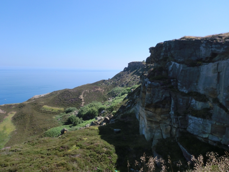
The monument includes remains of the Boulby Alum Quarries and associated
features, which lie on north facing coastal cliffs 1.5km north of Easington.
The monument includes quarries, the remains of structures used for initial
processing and transport of the alum on the quarry floor and an ironstone
mine. The monument extends for about 1km along the coastline and the
quarry face is up to 200m inland from the current cliff edge. The workings
originally extended further north, but substantial areas have been lost to
coastal erosion.
The Boulby alum works was one of the most productive and long lived in the
region. They were started in the 1650s by the Conyers family of Boulby Manor
and soon after control passed to the Baker-Baker family. Despite fluctuations
in the price of alum in the 18th century the works thrived and in 1784
expanded westward with the opening of the New Works. Technological
improvements led to further increases in production and the halving of
the workforce. However, advances in the alum industry elsewhere were having a
serious effect on the industry in the region, making the use of massive
calcining clamps at Boulby uneconomic. The sale of by-products such as Epsom
salts and slam (a material used in glass manufacture) prolonged its life until
the closure of the works in 1871.
The alum was extracted from a seam of alum shale up to 60m thick which lay
beneath a capping of sandstone. This overburden of stone was removed and much
was used for building stone. There are two discrete areas of quarrying, the
earliest being at the east end at Rockhole Hill where a large quarry scoop
with three terraces survives. These are the remains of a stepped quarry face.
The quarry waste generated was dumped on the land to the east where a series
of spoil heaps still survive. To the west of Rockhole is the second area of
quarrying known as New Works. This is separated from Rockhole by two large
flat topped spoil tips formed from dumping waste material from New Works into
the old quarry area to the east. The New Works consist of a long scree slope
that descends from the back of the quarry from which massive boulders have
fallen. Beyond this is a complicated series of terraces, quarry scoops and
dumps that cut and re-cut each other through several phases. The sequence of
quarrying became more complicated as the mining progressed westward and
material was dumped to the east where it appears to have been modified or
re-used in later periods of activity. At the west end, large stone revetment
walls were built partly to support the sides of the quarry scoops whilst
processing took place within the quarry floor and also to store burnt shale.
The first stage of processing was calcination, which occurred in large clamps.
Remains of these survive as large mounds of shale known as calcination bases,
some of which were vented from below by stone tunnels which still survive. The
next stage was steeping which occurred in stone lined pits. There were a total
of 17 steeping pits in the New Works, but only fragments now survive
protruding from the cliff edge, the remainder having been lost to coastal
collapse. Remains of further steeping pits survive along the level area at the
north edge of the Rockhole quarry. Excavations in the 1960s found several
structures including three roomed buildings at Rockhole and at New Works,
which are still exposed. These buildings are thought to be laboratories or a
blacksmith's workshop.
Extending west to east are the partial remains of a stone culvert which
supported a wooden channel known as a liqour trough. This carried alum from
the steeping pits to the alum house located to the east of the monument. Some
cisterns, reservoirs, tunnels and further buildings, including a mess hut,
also survive as visible structures.
Remains of other structures such as culverts, workshops, offices and stores
are also thought to survive below ground level throughout the monument.
In the south east of the New Works is the remains of an ironstone drift mine
tunnelled into the base of the quarry face.
MAP EXTRACT
The site of the monument is shown on the attached map extract.
Source: Historic England
Alum is a chemical used principally in the textile industry for fixing dyes.
It is not found in a natural state in Britain but can be manufactured from
some types of shale. During the medieval period in Britain alum was imported,
mostly from Italy. Domestic production began in the north of England in the
early 17th century. The industry flourished in the north for 200 years until
the mid-19th century when it was overtaken by new techniques using shale from
coal mining, whilst after 1880 aluminium sulphate replaced alum for most
industrial purposes. The last English aluminium works (at Goole) closed in
1950. Approximately 50 alum sites have been identified in England. Most were
along the Cleveland and Yorkshire coast. Other early sites are known on the
south coast, particularly in Dorset and Hampshire.
Alum works comprise two main monument types: the quarry where extraction and
initial processing took place, and the alum house where final processing took
place. Alum shale was extracted from quarries sited on steep inland hillsides
or coastal cliffs. Initial processing on the quarry floor consisted of
calcination by burning shale in clamps, and the production in settling pits of
alum liquor. The liquor was transported to processing works in sealed casks or
through wooden channels known as liquor troughs. Larger quarries possessed
inclines and haulage gear and sometimes harbour facilities. Stores, workshops
and laboratories can also survive. Evidence of secondary industries such as
epsom salts and iron silicates production is also preserved at alum works.
The alum industry was the first chemical industry in Britain. Its quarries and
works illustrate the early stages of the industry and the technological
advances through the period known as the Industrial Revolution. The alum
industry also offers important information about wider changes in social and
economic conditions during this period. The large scale of the industry's
workings also mean that its remains are today a major component of coastal
landscapes. A sample of the better preserved sites, illustrating the regional,
chronological and technological range of this class of monument, is considered
to merit protection.
The alum quarries and associated works at Boulby survive well and significant
remains of the technological processes are preserved. The Boulby quarry is one
of the best national examples of a technically advanced alum quarrying
complex. As a multi-period site the monument demonstrates the advances in
technology and innovation over the years. The monument has a wider landscape
importance as the nearby hamlet of Boulby was built almost exclusivly for the
alum workers. Thus the site is also important for the study of social and
domestic conditions.
Source: Historic England
Books and journals
Blood, K, Boulby Alum Mine, (1993), 12
Blood, K, Boulby Alum Mine, (1993), 1-20
Chapman, K, 'Cleveland Industrial Archaeologist' in Exavations at Boulby Alum Works, , Vol. 2, (1975), 27-34
Source: Historic England
Other nearby scheduled monuments