Approximate Location Map
Large Map »
This site is entirely user-supported. See how you can help.
If Google Street View is available, the image is from the best available vantage point looking, if possible, towards the location of the monument. Where it is not available, the satellite view is shown instead.
Latitude: 54.4173 / 54°25'2"N
Longitude: -0.5916 / 0°35'29"W
OS Eastings: 491488.588426
OS Northings: 503339.722686
OS Grid: NZ914033
Mapcode National: GBR SK9C.Q9
Mapcode Global: WHGBB.W7FG
Entry Name: Two round barrows known as Thorn Key Howes, on Low Moor
Scheduled Date: 6 July 1934
Last Amended: 2 October 2001
Source: Historic England
Source ID: 1019794
English Heritage Legacy ID: 31364
County: North Yorkshire
Civil Parish: Fylingdales
Traditional County: Yorkshire
Lieutenancy Area (Ceremonial County): North Yorkshire
Church of England Parish: Fylingdales St Stephen
Church of England Diocese: York
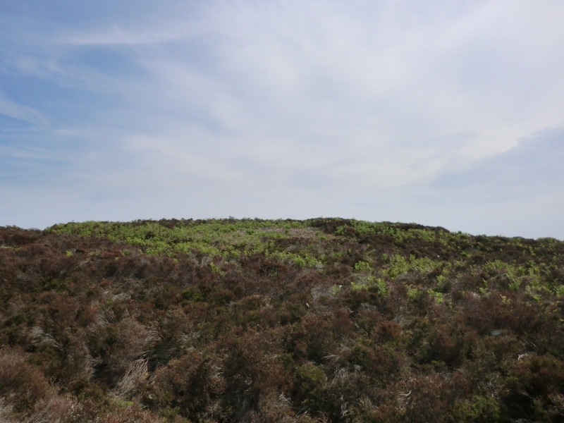
The monument includes two adjacent round barrows located in a prominent
position overlooking low lying moorland to the south. They lie on the
easternmost extent of the sandstone, heather covered moor characteristic of
the North York Moors. Today the moor is little used but archaeological
evidence indicates that this has not always been the case. The prehistoric
period in particular saw extensive agricultural use of the area. It was also
then being used for burials and activities associated with the carving of
patterns on exposed rock. Remains of these activities survive today.
Each barrow has an earth and stone mound. They lie 10m apart. The northern
mound is flat-topped and measures 8m in diameter and is 0.5m high. It is
surrounded by a broad, shallow ditch 1m wide and 0.4m deep. Outside the ditch
there is a slight counterscarp bank up to 3m wide. The southern mound measures
10m in diameter and is 0.4m high. It was surrounded by a ditch up to 3m wide
which has been filled in and is no longer visible as an earthwork. Both
barrows have been disturbed by excavation in the past indicated by a slight
hollow in the centre of each mound.
MAP EXTRACT
The site of the monument is shown on the attached map extract.
It includes a 2 metre boundary around the archaeological features,
considered to be essential for the monument's support and preservation.
Source: Historic England
Round barrows are funerary monuments dating from the Late Neolithic period to
the Late Bronze Age, with most examples belonging to the period 2400-1500 BC.
They were constructed as earthen mounds, sometimes ditched, which covered
single or multiple burials. They occur either in isolation or grouped as
cemeteries and often acted as a focus of burials in later periods. Often
superficially similar, although differing widely in size, they exhibit
regional variations in form and a diversity of burial practices. There are
over 10,000 surviving examples recorded nationally (many more have already
been destroyed), occurring across most of Britain, including the Wessex area
where it is often possible to classify them more closely, for example as bowl
or bell barrows. Often occupying prominent locations, they are a major
historic element in the modern landscape and their considerable variation in
form and longevity as a monument type provide important information on the
diversity of beliefs and social organisations amongst early prehistoric
communities. They are particularly representative of their period and a
substantial proportion of surviving examples are considered worthy of
protection.
The two round barrows known as Thorn Key Howes, on Low Moor have survived
well, and significant information about the original form of the barrows and
the burials placed within them will be preserved. Evidence of earlier land use
will also survive beneath the barrow mounds. The monument lies in an area rich
in similar monuments and offers important scope for the study of social and
ritual activities in the region during the prehistoric period.
Source: Historic England
Books and journals
Smith, M J B, Excavated Bronze Age Burial Mounds of Durham and N' land., (1994), 1-34
Source: Historic England
Other nearby scheduled monuments