Approximate Location Map
Large Map »
This site is entirely user-supported. See how you can help.
If Google Street View is available, the image is from the best available vantage point looking, if possible, towards the location of the monument. Where it is not available, the satellite view is shown instead.
Latitude: 52.4907 / 52°29'26"N
Longitude: -2.4388 / 2°26'19"W
OS Eastings: 370299.385041
OS Northings: 288181.906672
OS Grid: SO702881
Mapcode National: GBR BY.J29T
Mapcode Global: VH83P.PN1G
Entry Name: Round barrow 65m south west of St Bartholomew's Church
Scheduled Date: 3 July 2000
Source: Historic England
Source ID: 1019199
English Heritage Legacy ID: 33802
County: Shropshire
Civil Parish: Glazeley
Traditional County: Shropshire
Lieutenancy Area (Ceremonial County): Shropshire
Church of England Parish: Glazeley and Deuxhill
Church of England Diocese: Hereford
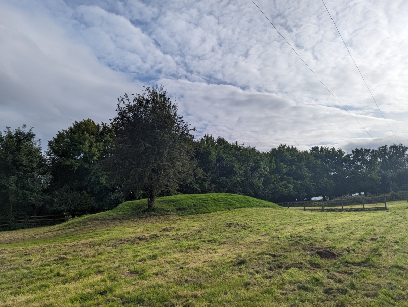
The monument includes the earthwork and buried remains of a Bronze Age round
barrow constructed of earth and situated on a gentle east to north east facing
slope in an area of undulating land. The barrow mound is about 21m in diameter
at its base. Its flat top, 8m across, may be the result of later modification.
In relation to the sloping ground on which it stands, the height of the mound
increases from 1.6m to 2.2m. Although no longer visible at ground level, a
ditch from which material was quarried during the construction of the
monument, surrounds the mound. This has become infilled over the years but
will survive as a buried feature, approximately 3m wide.
All fence posts are excluded from the scheduling, although the ground beneath
them is included.
MAP EXTRACT
The site of the monument is shown on the attached map extract.
It includes a 2 metre boundary around the archaeological features,
considered to be essential for the monument's support and preservation.
Source: Historic England
Round barrows are funerary monuments dating from the Late Neolithic period to
the Late Bronze Age, with most examples belonging to the period 2400-1500 BC.
They were constructed as earthen mounds, sometimes ditched, which covered
single or multiple burials. They occur either in isolation or grouped as
cemeteries and often acted as a focus of burials in later periods. Often
superficially similar, although differing widely in size, they exhibit
regional variations in form and a diversity of burial practices. There are
over 10,000 surviving examples recorded nationally (many more have already
been destroyed), occurring across most of Britain, including the Wessex area
where it is often possible to classify them more closely, for example as bowl
or bell barrows. Often occupying prominent locations, they are a major
historic element in the modern landscape and their considerable variation in
form and longevity as a monument type provide important information on the
diversity of beliefs and social organisations amongst early prehistoric
communities. They are particularly representative of their period and a
substantial proportion of surviving examples are considered worthy of
protection.
The round barrow 65m south west of St Bartholomew's Church is a well-preserved
example of this class of monument. It is a rare survival in an area where
similar examples have been levelled by the plough. The barrow mound will
retain evidence for its method of construction as well as the burials within
it. These remains will advance our understanding of Bronze Age society,
including the ritual practices and technical abilities of these people. The
accumulated ditch fills will preserve environmental evidence for the
activities which took place at the site, during the construction of the barrow
and its subsequent use. In addition, the buried ground surface beneath the
mound will preserve evidence for the landscape in which the barrow was built.
Source: Historic England
Other nearby scheduled monuments