Approximate Location Map
Large Map »
This site is entirely user-supported. See how you can help.
If Google Street View is available, the image is from the best available vantage point looking, if possible, towards the location of the monument. Where it is not available, the satellite view is shown instead.
Latitude: 54.3353 / 54°20'7"N
Longitude: -0.7025 / 0°42'9"W
OS Eastings: 484461.996222
OS Northings: 494083.207
OS Grid: SE844940
Mapcode National: GBR RLJ9.PN
Mapcode Global: WHGBP.59Q9
Entry Name: Round barrow 660m south west of Glebe Farm
Scheduled Date: 9 March 2001
Source: Historic England
Source ID: 1019751
English Heritage Legacy ID: 34808
County: North Yorkshire
Civil Parish: Lockton
Traditional County: Yorkshire
Lieutenancy Area (Ceremonial County): North Yorkshire
Church of England Parish: Levisham St John the Baptist
Church of England Diocese: York
The monument includes a round barrow situated on level ground on the northern
part of Levisham Moor. Levisham Moor lies on the southern edge of the
sandstone, predominantly heather covered moor characteristic of the North York
Moors. The moor occupies the northern part of a block of land defined by the
deep valleys of Newton Dale to the west, Horcum Slack to the east, Havern Beck
to the north and Levisham Beck to the south. The eastern side of the moor is
bisected by smaller valleys known locally as griffs which divide the moor into
a series of flat-topped peninsulas with steep slopes on all but their north
western sides. The southern part of the block of land has been enclosed and
brought into agricultural use, however, buried traces of prehistoric remains
in this area are visible on aerial photographs. Today the moor is little used
but archaeological evidence indicates that this has not always been the case.
Both the prehistoric and medieval periods saw intensive use of the land for
agricultural, industrial and ritual purposes. Remains of these activities
survive today.
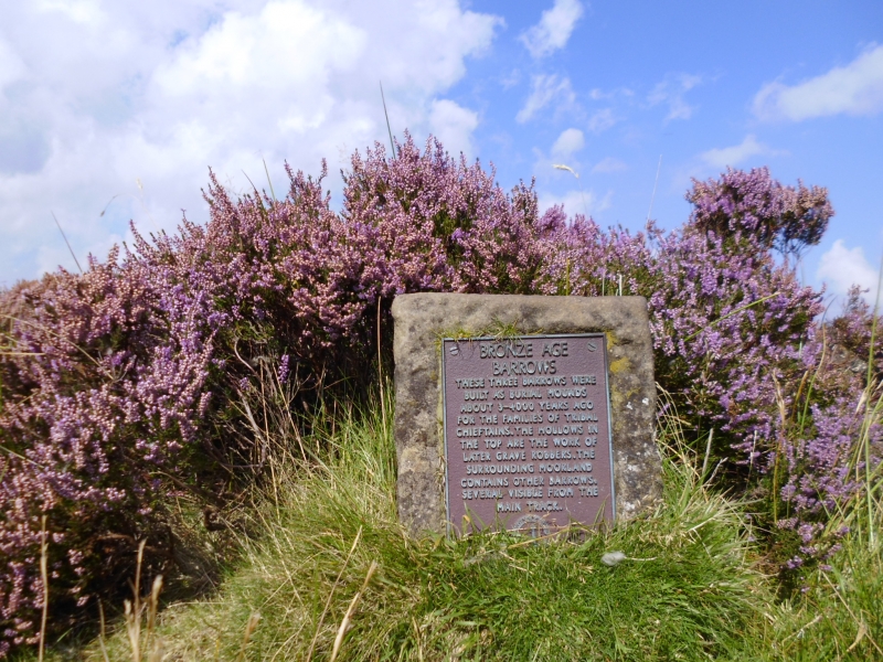
The barrow has an earth and stone mound standing 0.5m high and measuring 11m
in diameter. The mound was surrounded by a ditch up to 3m wide which has been
filled in and is no longer visible as an earthwork. There is a wide shallow
hole in the centre of the mound which is the result of investigations in the
past.
MAP EXTRACT
The site of the monument is shown on the attached map extract.
It includes a 2 metre boundary around the archaeological features,
considered to be essential for the monument's support and preservation.
Source: Historic England
Round barrows are funerary monuments dating from the Late Neolithic period to
the Late Bronze Age, with most examples belonging to the period 2400-1500 BC.
They were constructed as earthen mounds, sometimes ditched, which covered
single or multiple burials. They occur either in isolation or grouped as
cemeteries and often acted as a focus of burials in later periods. Often
superficially similar, although differing widely in size, they exhibit
regional variations in form and a diversity of burial practices. There are
over 10,000 surviving examples recorded nationally (many more have already
been destroyed), occurring across most of Britain, including the Wessex area
where it is often possible to classify them more closely, for example as bowl
or bell barrows. Often occupying prominent locations, they are a major
historic element in the modern landscape and their considerable variation in
form and longevity as a monument type provide important information on the
diversity of beliefs and social organisations amongst early prehistoric
communities. They are particularly representative of their period and a
substantial proportion of surviving examples are considered worthy of
protection.
The round barrow 660m south west of Glebe Farm has survived well. Significant
information about the original construction of the barrow, the burials placed
within it and the relationship with other monuments in the area will be
preserved. Evidence of earlier land use will also survive beneath the barrow
mound.
Source: Historic England
Books and journals
Atkins, C, An Archaeological Survey of the Levisham Estate, (1991), 5-12
Source: Historic England
Other nearby scheduled monuments