Approximate Location Map
Large Map »
This site is entirely user-supported. See how you can help.
If Google Street View is available, the image is from the best available vantage point looking, if possible, towards the location of the monument. Where it is not available, the satellite view is shown instead.
Latitude: 54.1393 / 54°8'21"N
Longitude: -3.1064 / 3°6'23"W
OS Eastings: 327811.782438
OS Northings: 472061.521292
OS Grid: SD278720
Mapcode National: GBR 6NRK.8X
Mapcode Global: WH72K.77Z2
Entry Name: Lime kiln 320m south east of Scales Green Farm
Scheduled Date: 6 October 2003
Source: Historic England
Source ID: 1021012
English Heritage Legacy ID: 35002
County: Cumbria
Civil Parish: Aldingham
Traditional County: Lancashire
Lieutenancy Area (Ceremonial County): Cumbria
Church of England Parish: Aldingham St Cuthbert
Church of England Diocese: Carlisle
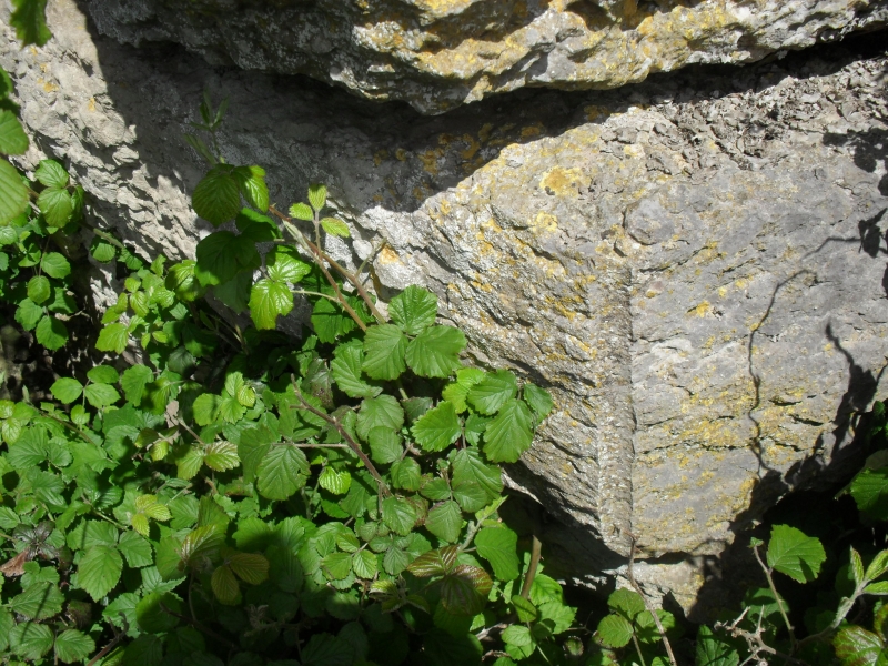
The monument includes a late 18th/early 19th century lime kiln located on
the southern edge of an area of outcropping limestone pavement 320m south
east of Scales Green Farm. It is a single pot draw hole type kiln which
was used to burn limestone. Typically the limestone was tipped into the
kiln from the top via the charge hole then burned using wood, coal or coke
as a fuel. The resultant quicklime, also known as birdlime or slaked lime,
was then shovelled out from the draw hole at the bottom of the kiln. Lime
has many uses including spreading on lime deficient soils to encourage
plant growth, the whitewashing of walls and ceilings of buildings, and
concrete and cement production. The lime kiln, which is one of three
different types in the vicinity, is a rounded or barrel-fronted structure
constructed of large blocks of coursed limestone rubble and is built into
the hillside. Its draw hole, also known as a fire hole, has a large flat
lintel above. The charge hole has largely been infilled. A flattened
surface above the kiln and to the rear of the charge hole is known as the
charging platform. It was used to hold small amounts of limestone which
were awaiting burning.
MAP EXTRACT
The site of the monument is shown on the attached map extract.
It includes a 2 metre boundary around the archaeological features,
considered to be essential for the monument's support and preservation.
Source: Historic England
Limestone or chalk has been the basic ingredient for lime mortar from at
least Roman times. Since the medieval period, lime has also been used as
agricultural fertiliser and, since the early 19th century, widely used in
a variety of other industries: as a flux in blast furnaces, in the
production of gas and oil, and in the chemical, pharmaceutical and food
industries.
The lime industry is defined as the processes of preparing and producing
lime by burning and slaking. The basic raw material for producing lime is
limestone or chalk: when burnt at high temperature (roasted or calcined),
these rocks release carbon dioxide, leaving `quicklime' which, by chemical
reaction when mixed with water (`slaking'), can be turned into a stable
powder - lime. Lime burning sites varied in scale from individual small
lime kilns adjacent to a quarry, to large-scale works designed to operate
commercially for an extended market and often associated with long
distance water or rail transport. Lime burning as an industry displays
well-developed regional characteristics, borne out by the regional styles
of East Anglia, West Gloucestershire or Derbyshire.
The form of kilns used for lime burning evolved throughout the history of
the industry, from small intermittent clamp and flare kilns, to large
continuously fired draw kilns that could satisfy increased demand from
urban development, industrial growth and agricultural improvement.
Small-scale rural lime production continued in the later 19th and 20th
centuries, but this period of the industry is mainly characterised by
large-scale production and the transfer of technologies from the cement
and other industries. The demand for mortars grew steadily during the 19th
and 20th centuries. The successful production of mortars made with
artificial cement represented an economic challenge to lime production and
gradually replaced the use of lime mortars in major construction and
engineering projects.
From a highly selective sample made at national level, around 200 lime
industry sites have been defined as being of national importance. These
have been defined to represent the industry's chronological depth,
technological breadth and regional diversity.
The lime kiln 320m south east of Scales Green Farm survives well and is a
good example of a late 18th/early 19th century draw kiln. Taken together with
two other kilns of differing form in the near vicinity, both of which are
the subject of separate schedulings, it displays the development of lime
kiln design and technology during the late 18th and early 19th centuries.
Source: Historic England
Books and journals
Keates, A C, 'Cumbria Industrial History Society' in Scales Green, (1995)
Other
SMR No. 17166, Cumbria SMR, Scales Green limestone quarry and lime kiln, Aldingham, (1988)
Source: Historic England
Other nearby scheduled monuments