Approximate Location Map
Large Map »
This site is entirely user-supported. See how you can help.
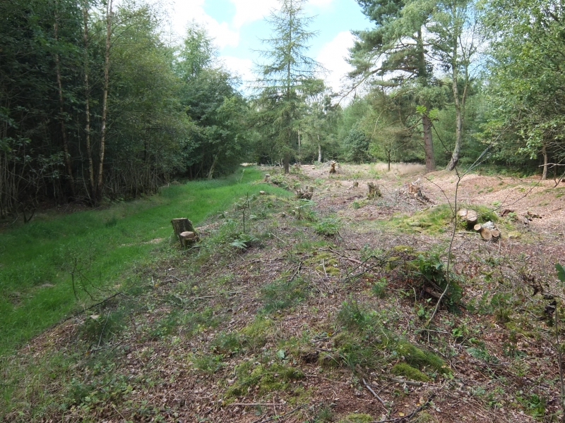
If Google Street View is available, the image is from the best available vantage point looking, if possible, towards the location of the monument. Where it is not available, the satellite view is shown instead.
Latitude: 54.2515 / 54°15'5"N
Longitude: -0.6954 / 0°41'43"W
OS Eastings: 485095.0835
OS Northings: 484759.3148
OS Grid: SE850847
Mapcode National: GBR RML8.7Q
Mapcode Global: WHGC2.9D2M
Entry Name: Two prehistoric linear boundaries with associated features, 680m ESE and 880m NNE of Pexton Moor Farm
Scheduled Date: 5 July 2002
Source: Historic England
Source ID: 1020699
English Heritage Legacy ID: 35433
County: North Yorkshire
Civil Parish: Thornton-le-Dale
Traditional County: Yorkshire
Lieutenancy Area (Ceremonial County): North Yorkshire
The monument includes a prehistoric linear boundary and the surviving part
of a second prehistoric linear boundary which are situated in Dalby
Forest, on the southern slopes of the Tabular Hills. Also included are a
round cairn, the boundary of a stock enclosure and the sites of two rabbit
traps, all of which are appended to, or adjacent to, the linear
boundaries. The monument is divided into two areas of protection which are
separated by the Dalby Forest Drive.
The first linear boundary runs approximately north to south along the top
of the steep east-facing slope into Thornton Dale; at its southern end it
turns towards the south west and runs along the top of Ellerburn Banks,
projecting beyond Dalby Forest into the Ellerburn Banks Nature Reserve and
agricultural fields. Originally the boundary consisted of a steep-sided
ditch running between two parallel banks of earth and stone, which had an
overall width between 14m and 18m. However, over the years the western
bank has largely been levelled by ploughing and forestry activities and is
no longer visible as an earthwork, although traces survive at the extreme
northern end, standing up to 0.3m high, and in the central part, standing
up to 0.6m high. The eastern bank stands between 0.9m and 2m high and the
ditch is between 0.9m and 2m deep, measured from the tops of the banks. At
the southern end of the boundary, the last 170m of the ditch have become
filled in as a result of ploughing in the field to the north west. At its
northern end, the boundary has a rounded terminal. For a 30m length to the
immediate north of the Nature Reserve, the western bank is visible with an
additional ditch on its western side, giving the boundary an overall width
of 21m.
To the west of the Nature Reserve, there is an irregular enclosure
adjoining the west side of the linear boundary and parallel to it. It
measures externally approximately 215m north to south by 135m east to
west, and is thought to be a stock enclosure associated with the linear
boundary. It is bounded on its western and northern sides by an earth and
stone bank which is 4.5m wide and stands up to 0.9m high. The bank is
continuous with the western bank of the linear boundary which forms the
eastern side of the enclosure; the ditch and eastern bank of the linear
boundary have their greatest width, depth and height alongside the
enclosure. Originally the enclosure would have had a ditch up to 2m wide
running along the inner edge of the enclosing bank. However, over the
years the ditch has become filled in as a result of ploughing within the
interior of the enclosure and it is no longer visible as an earthwork
feature, although a slight depression along the line of the ditch can be
seen in the northern side adjacent to a modern breach in the enclosure
bank which provides the modern field access. The line of the ditch in the
north east corner of the enclosure has been disturbed by quarrying. The
southern side of the enclosure is open.
The two rabbit traps have been identified from the 1912 editions of the
Ordnance Survey maps. They were originally constructed on or within the
western bank of the linear boundary but over the years they have collapsed
and become levelled so that they are no longer visible, although slight
depressions can be seen in the ground surface at their approximate
locations.
The second linear boundary follows a sinuous course between the heads of
Orchan Dale and the edge of Thornton Dale, running in an approximate east
to west direction and turning to the south towards the western end. It
consists of two approximately parallel ditches, each with a pair of
flanking earth and stone banks. For most of its length it has an overall
maximum width of 14m, except at the eastern end where the width increases
to 16m and at the western end where there is a gap between the two sets of
ditches and banks which increases the width to between 17m and 25m. Over
the years the boundary has become fragmented and parts of it have been
levelled as a result of forestry activities, so that in the central
section only the outer banks and traces of the ditches survive. The banks
stand between 0.4m and 0.7m high and the ditches have a maximum depth of
1m measured from the tops of the banks. At its western end the boundary
stops abruptly at the edge of a field; ploughing has levelled the boundary
in the field to the south so that its original extent is not known. For
the last 30m at its eastern end, the boundary was recut as a single ditch,
up to 1.7m deep, running between two banks, standing between 0.3m and 0.5m
high, and this turns to the north to run into the first linear boundary at
its northern end; this part of the east-west linear boundary was recut
after the north-south linear boundary was constructed since its southern
bank lies across the ditch of the north-south linear boundary. The round
cairn adjoins the southern side of the east-west linear boundary. It has a
stone mound which measures 5m in diameter and stands up to 0.5m high. The
monument forms part of a network of prehistoric linear boundaries which is
surrounded by many other prehistoric monuments, particularly burials.
A number of features are excluded from the scheduling. These are: the
surfaces of the forestry tracks running north to south and north west to
south east across the northern and southern parts of the monument
respectively, the surfaces of the north-south footpath along the western
side of the monument and of the Forestry Commission's Haygate car park at
the northern end of it, the sign boards in the Haygate car park and in the
Ellerburn Banks Nature Reserve, the bench and its concrete supporting
platform adjacent to the footpath along the southern part of the monument
and all fence posts along modern field boundaries at the northern, western
and southern ends of the monument and at the southern end of the Haygate
car park; however, the ground beneath all these features is included.
MAP EXTRACT
The site of the monument is shown on the attached map extract.
Source: Historic England
Linear boundaries are substantial earthwork features comprising single or
multiple ditches and banks which may extend over distances varying between
less than 1km to over 10km. They survive as earthworks or as linear features
visible as cropmarks on aerial photographs or as a combination of both. The
evidence of excavation and study of associated monuments demonstrate that
their construction spans the millennium from the Middle Bronze Age, although
they may have been re-used later.
The scale of many linear boundaries has been taken to indicate that they were
constructed by large social groups and were used to mark important boundaries
in the landscape; their impressive scale displaying the corporate prestige of
their builders. They would have been powerful symbols, often with religious
associations, used to define and order the territorial holdings of those
groups who constructed them. Linear earthworks are of considerable importance
for the analysis of settlement and land use in the Bronze Age; all well
preserved examples will normally merit statutory protection.
Round cairns are prehistoric funerary monuments dating to the Bronze Age
(c.2000-700 BC). They were constructed as stone mounds covering single or
multiple burials. These burials may be placed within the mound in
stone-lined compartments called cists. In some cases the cairn was
surrounded by a ditch. Often occupying prominent locations, cairns are a
major visual element in the modern landscape. They are a relatively common
feature of the uplands and are the stone equivalent of the earthen round
barrows of the lowlands. Their considerable variation in form and
longevity as a monument type provide important information on the
diversity of beliefs and social organisation amongst early prehistoric
communities. They are particularly representative of their period and a
substantial proportion of surviving examples are considered worthy of
protection.
Despite limited disturbance, the components of this monument, two
prehistoric linear boundaries with associated features in Dalby Forest
680m ESE and 880m NNE of Pexton Moor Farm, have survived well. Significant
information will be preserved about their original form and the nature and
duration of their use. Important environmental evidence which can be used
to date the boundaries and associated features, and determine contemporary
land use and economy will be preserved within the lowest ditch fills.
Evidence for earlier land use will be preserved in the old ground surface
beneath the banks and the cairn. Stratigraphic relationships between the
different components of the monument will survive and provide evidence for
the sequence of construction and development.
These linear boundaries are among several boundaries which divide the area
between Thornton Dale in the east and Newton Dale in the west. They are
thought to represent part of a system of territorial land division which
was constructed to augment natural divisions of the landscape by river
valleys and watersheds. This system is one of many such groups of
boundaries found on the Tabular Hills. The monument lies close to the site
of an Iron Age cart burial in an area which also includes other burial
monuments. Associated groups of monuments such as this offer important
scope for the study of land use for social, ritual and agricultural
purposes during the later prehistoric period.
Source: Historic England
Books and journals
Lax, A, The Moor Dike, Wykeham Forest. Archaeological survey report, (1996)
Northern Archaeological Associates, , North York Moors Forest Survey Phase Two, (1996)
Northern Archaeological Associates, , North York Moors Forest Survey Phase Two, (1996)
Spratt, D A, Linear Earthworks of the Tabular Hills: North East Yorkshire, (1989), 29-32
Stead, I M, 'Antiquity' in A Chariot Burial on Pexton Moor, North Riding, , Vol. 33, (1959), 214-216
Other
8113,
Title: 2nd Edition 25" Ordnance Survey sheet 92/5
Source Date: 1912
Author:
Publisher:
Surveyor:
Source: Historic England
Other nearby scheduled monuments