Approximate Location Map
Large Map »
This site is entirely user-supported. See how you can help.
If Google Street View is available, the image is from the best available vantage point looking, if possible, towards the location of the monument. Where it is not available, the satellite view is shown instead.
Latitude: 54.3838 / 54°23'1"N
Longitude: -0.7308 / 0°43'50"W
OS Eastings: 482527.5102
OS Northings: 499443.512
OS Grid: SE825994
Mapcode National: GBR RKBR.L9
Mapcode Global: WHF9B.R26M
Entry Name: Two Howes: two round barrows on Goathland Moor
Scheduled Date: 18 June 1968
Last Amended: 24 February 2004
Source: Historic England
Source ID: 1021296
English Heritage Legacy ID: 35918
County: North Yorkshire
Civil Parish: Goathland
Traditional County: Yorkshire
Lieutenancy Area (Ceremonial County): North Yorkshire
Church of England Parish: Goathland St Mary
Church of England Diocese: York
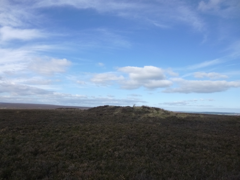
The monument includes two round barrows which occupy a prominent ridge-top
position on Two Howes Rigg. It lies on Middle Jurassic sandstone on the
North York Moors. The two barrows are in two separate areas of protection.
Each barrow has a well-defined sub-circular mound constructed from earth
and stone. Both have hollows in the centre left by partial excavation in
the past.
The north western mound measures 20m in diameter and stands up to 1.3m
high, although it has been augmented on the north western edge by spoil
from the partial excavation and it is up to 1.7m high here. The mound was
originally constructed with an internal kerb. This would have been a
circle of large stones or boulders, about 15m-16m in diameter, included
within the matrix of the mound, and some of these stones are visible where
the mound surface has become eroded.
The second barrow lies 110m to the south east. Its mound measures 16m in
diameter and stands up to 1.2m high. Both barrows are eroded by modern
footpaths and have modern walkers' cairns built upon them: the cairn on
the north western barrow is to the north west of the centre and that on
the south eastern barrow is to the south east of the centre.
The barrows are surrounded by many other prehistoric monuments,
particularly further burials, which are often located in prominent and
highly visible locations in the landscape.
MAP EXTRACT
The site of the monument is shown on the attached map extract.
It includes a 2 metre boundary around the archaeological features,
considered to be essential for the monument's support and preservation.
Source: Historic England
Round barrows are funerary monuments dating from the Late Neolithic period to
the Late Bronze Age, with most examples belonging to the period 2400-1500 BC.
They were constructed as earthen mounds, sometimes ditched, which covered
single or multiple burials. They occur either in isolation or grouped as
cemeteries and often acted as a focus of burials in later periods. Often
superficially similar, although differing widely in size, they exhibit
regional variations in form and a diversity of burial practices. There are
over 10,000 surviving examples recorded nationally (many more have already
been destroyed), occurring across most of Britain, including the Wessex area
where it is often possible to classify them more closely, for example as bowl
or bell barrows. Often occupying prominent locations, they are a major
historic element in the modern landscape and their considerable variation in
form and longevity as a monument type provide important information on the
diversity of beliefs and social organisations amongst early prehistoric
communities. They are particularly representative of their period and a
substantial proportion of surviving examples are considered worthy of
protection.
Despite disturbance from excavation in the past and modern erosion, the
Two Howes have significant surviving archaeological deposits. These will
preserve information about the date and original form of the barrows and
the burials placed within them. Evidence for earlier land use and the
contemporary environment will also survive beneath the mounds.
Clusters of burial monuments, such as this pair of barrows, provide
important insight into the development of ritual and funerary practice
during the Bronze Age. The barrows lie close to a number of other
prehistoric monuments and these associations contribute to our
understanding of prehistoric landscape exploitation.
Source: Historic England
Books and journals
Hind, D, Goathland Moor Monument Survey, (1996), 6
Spratt, D A , 'Prehistoric and Roman Archaeology in North East Yorkshire' in Prehistoric and Roman Archaeology of North East Yorkshire, (1993)
Source: Historic England
Other nearby scheduled monuments