Approximate Location Map
Large Map »
This site is entirely user-supported. See how you can help.
If Google Street View is available, the image is from the best available vantage point looking, if possible, towards the location of the monument. Where it is not available, the satellite view is shown instead.
Latitude: 51.4472 / 51°26'49"N
Longitude: -2.6008 / 2°36'2"W
OS Eastings: 358343.386288
OS Northings: 172189.633017
OS Grid: ST583721
Mapcode National: GBR C6N.S2
Mapcode Global: VH88M.VWXH
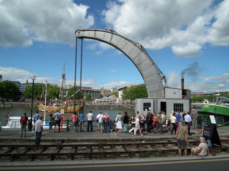
Entry Name: Fairbairn Crane, Bristol Harbour
Scheduled Date:
Source: Historic England
Source ID: 1005418
English Heritage Legacy ID: BS 7
County: Bristol
Electoral Ward/Division: Hotwells and Harbourside
Built-Up Area: Bristol
Traditional County: Somerset
Lieutenancy Area (Ceremonial County): Bristol
Church of England Parish: St Mary Redcliffe with Temple, Bristol and St John the Baptist, Bedminster
Church of England Diocese: Bristol
This record has been generated from an "old county number" (OCN) scheduling record. These are monuments that were not reviewed under the Monuments Protection Programme and are some of our oldest designation records. As such they do not yet have the full descriptions of their modernised counterparts available. Please contact us if you would like further information.
Source: Historic England
Other nearby scheduled monuments