Approximate Location Map
Large Map »
This site is entirely user-supported. See how you can help.
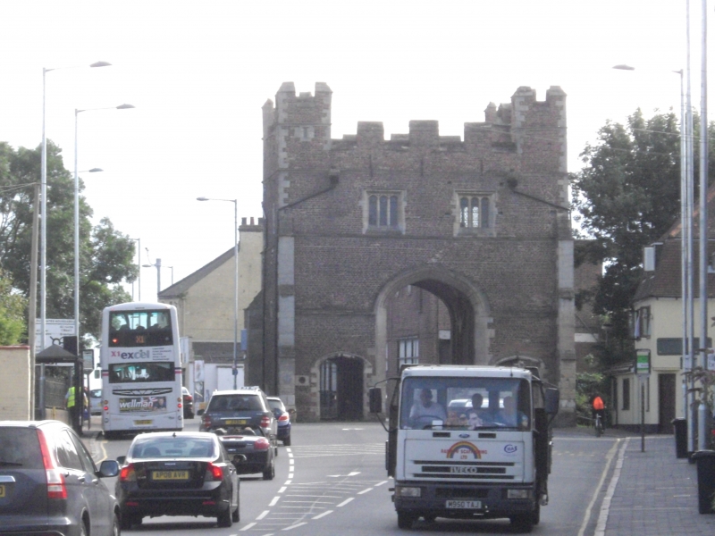
If Google Street View is available, the image is from the best available vantage point looking, if possible, towards the location of the monument. Where it is not available, the satellite view is shown instead.
Latitude: 52.7456 / 52°44'44"N
Longitude: 0.4015 / 0°24'5"E
OS Eastings: 562197.757603
OS Northings: 319151.049592
OS Grid: TF621191
Mapcode National: GBR N3R.SD2
Mapcode Global: WHJP7.47FY
Entry Name: The Former South Gate and Southgates Bridge
Scheduled Date: 30 November 1925
Last Amended: 30 October 2020
Source: Historic England
Source ID: 1003699
English Heritage Legacy ID: NF 174 B
County: Norfolk
Electoral Ward/Division: South and West Lynn
Built-Up Area: King's Lynn
Traditional County: Norfolk
Lieutenancy Area (Ceremonial County): Norfolk
This record has been generated from an "old county number" (OCN) scheduling record. These are monuments that were not reviewed under the Monuments Protection Programme and are some of our oldest designation records. As such they do not yet have the full descriptions of their modernised counterparts available. Please contact us if you would like further information.
Source: Historic England
Other nearby scheduled monuments