Approximate Location Map
Large Map »
This site is entirely user-supported. See how you can help.
If Google Street View is available, the image is from the best available vantage point looking, if possible, towards the location of the monument. Where it is not available, the satellite view is shown instead.
Latitude: 55.7895 / 55°47'22"N
Longitude: -4.8476 / 4°50'51"W
OS Eastings: 221556
OS Northings: 658805
OS Grid: NS215588
Mapcode National: GBR 31.891K
Mapcode Global: WH2N1.HRV1
Entry Name: Castle Hill, fort
Scheduled Date: 4 March 2002
Source: Historic Environment Scotland
Source ID: SM10390
Schedule Class: Cultural
Category: Prehistoric domestic and defensive: fort (includes hill and promontory fort)
Location: Largs
County: North Ayrshire
Electoral Ward: North Coast and Cumbraes
Traditional County: Ayrshire
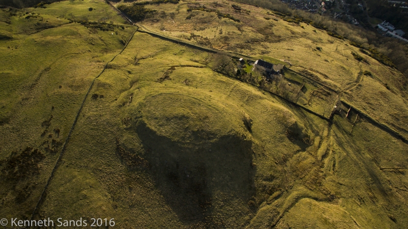
The monument comprises the remains of a fort, probably dating from the Iron Age (around 2000 years ago).
The fort is situated on a rocky knoll above the S side of the mouth of the Gogo Water. It comprises the remains of an enclosing rampart situated around the edge of the summit of the knoll. On the NE, W and S sides of the hill are steep natural slopes, and there is a gully around the base of the knoll in the E.
The enclosing rampart is sub-oval on plan and measures at least 57m from NE to SW by 38m transversely. It is best preserved around the S perimeter, where it measures about 2m in thickness, although substantial stretches can also be seen elsewhere on the circuit. A distinct shallow foundation trench for a wall base is visible on the W. There are no visible ground surface remains in the interior of the fort. The most likely place for an entrance is on the NE, where there is a winding approach.
The area to be scheduled comprises the remains described and an area around them within which related evidence may be expected to survive. It is irregular on plan and has maximum dimensions of approximately 105m from NE to SW by 85m transversely, as shown in red on the accompanying map.
Source: Historic Environment Scotland
Bibliography
No Bibliography entries for this designation
Source: Historic Environment Scotland
Other nearby scheduled monuments