Approximate Location Map
Large Map »
This site is entirely user-supported. See how you can help.
If Google Street View is available, the image is from the best available vantage point looking, if possible, towards the location of the monument. Where it is not available, the satellite view is shown instead.
Latitude: 57.6841 / 57°41'2"N
Longitude: -6.3469 / 6°20'48"W
OS Eastings: 140996
OS Northings: 874341
OS Grid: NG409743
Mapcode National: GBR B8QD.TX2
Mapcode Global: WGY5P.G4W3
Entry Name: Duntulm Castle
Scheduled Date: 9 March 1992
Source: Historic Environment Scotland
Source ID: SM5307
Schedule Class: Cultural
Category: Secular: castle
Location: Kilmuir
County: Highland
Electoral Ward: Eilean á Chèo
Traditional County: Inverness-shire
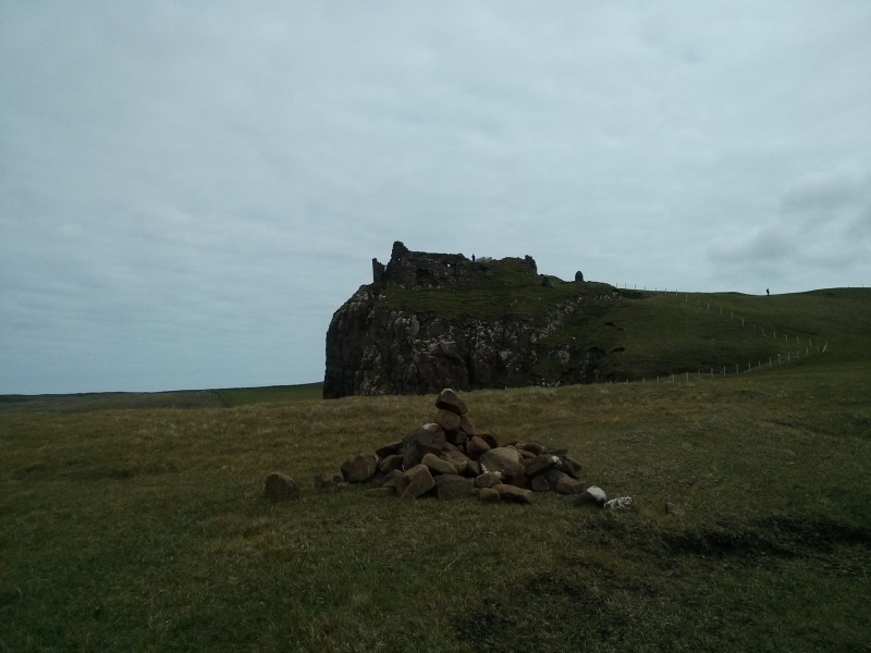
The monument consists of the remains of a courtyard castle,built in the 14th-15th centuries but with subsequent additions. The landward side of the Castle, which is situated on a cliffed promontory, is protected by a man made ditch crossed by a later causeway.
Substantial sections of the courtyard wall survive to a thickness of 2m, showing 16th century modifications in response to changes in the design of artillery fortifications. The only surviving entrance is the sea gate, in the N curtain wall. The dominating feature of the Castle was the tower which provided the main residential
accommodation for the MacDonald chiefs and their retinue.
This was 4 storeys high. One wall of this survived to parapet level until the late 19th century. The lower orders of a later bartizan tower, of later date, also survived until this date. All that now survives of these elements is a vaulted basement kitchen. An additional tower was built, possibly in the 16th century, abutting the N face of the earlier and larger tower. It was probably 3 storeys high and communicated directly with the larger tower.
The upper part of this tower collapsed in 1990. The most recent building within the courtyard was built in the NW corner during the 17th century. Evidence of doorways in W and E walls, a window in the N gable and joist holes along the W wall survive. There may have been other buildings within the courtyard, although no remains are visible.
The area to be scheduled is irregular in plan, 80m N-S by 90m E-W, defined to the N by the mean high water mark of the shore, to include the castle, the outer ditch and causeway and the surrounding slopes, as marked in red on the accompanying map.
Source: Historic Environment Scotland
The monument is of national importance as a fine example of a 14th-15th century courtyard castle, subsequently modified to take account of changing social and defensive requirements. Although mow ruinous it must have been a fitting residence for the MacDonalds of Sleat. It is a rare survival in NW Scotland and has the potential to contribute to our knowledge of Scottish buildings where domestic and defensive considerations have combined to determine both plan and design.
Source: Historic Environment Scotland
Bibliography
RCAHMS records the monument as NG 47 SW 1.
Source: Historic Environment Scotland
Other nearby scheduled monuments