Approximate Location Map
Large Map »
This site is entirely user-supported. See how you can help.
If Google Street View is available, the image is from the best available vantage point looking, if possible, towards the location of the monument. Where it is not available, the satellite view is shown instead.
Latitude: 50.0774 / 50°4'38"N
Longitude: -5.1795 / 5°10'46"W
OS Eastings: 172613.040008
OS Northings: 24538.806156
OS Grid: SW726245
Mapcode National: GBR Z6.CBKW
Mapcode Global: FRA 081T.1Z5
Entry Name: Round with annexe called 'Caer Vallack'
Scheduled Date: 29 November 1957
Source: Historic England
Source ID: 1004429
English Heritage Legacy ID: CO 435
County: Cornwall
Civil Parish: St. Martin-in-Meneage
Traditional County: Cornwall
Lieutenancy Area (Ceremonial County): Cornwall
Church of England Parish: St Martin-in-Meneage
Church of England Diocese: Truro
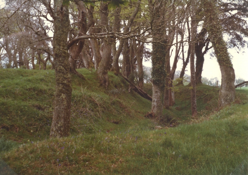
The monument includes a round with an annexe, situated on a prominent ridge, overlooking the steep valley of a tributary to the Helford River. The round survives as an oval enclosure defined by a single rampart up to 2m high and outer ditch up to 2.5m deep with a counterscarp bank confined to the southern side. There is a simple entrance to the north east. To the east, immediately adjacent to the round, is an annexe of elongated oval shape defined by a single rampart with outer ditch. The rampart and ditch are cut to the east by a road and to the north by a later park pale.
The name is derived from the Cornish 'ker' meaning fort or round and since the round gave its name to the nearby settlement it received its first indirect reference in 1070. Polwhele first recorded it in 1803, and in the 19th century Thomas described how its eastern end had been cut by a road, although part survived beyond the road to the east. By the time Henderson recorded it in the 1920s this truncated eastern part had been destroyed.
Sources: HER:-
PastScape Monument No:-427437
Source: Historic England
Rounds are small embanked enclosures, one of a range of settlement types dating to between the later Iron Age and the early post-Roman period. Usually circular or oval, they have a single earth and rubble bank and an outer ditch, with one entrance breaking the circuit. Excavations have produced drystone supporting walls within the bank, paved or cobbled entrance ways, post built gate structures, and remains of timber, turf or stone built houses of oval or rectangular plan, often set around the inner edge of the enclosing bank. Other evidence includes hearths, drains, gullies, pits and rubbish middens. Evidence for industrial activities has been recovered from some sites, including small scale metal working and, among the domestic debris, items traded from distant sources. Some rounds are associated with secondary enclosures, either abutting the round as an annexe or forming an additional enclosure. Rounds are viewed primarily as agricultural settlements, the equivalents of farming hamlets. They were replaced by unenclosed settlement types by the 7th century AD. Over 750 rounds are recorded in the British Isles, occurring in areas bordering the Irish Seas, but confined in England to south west Devon and especially Cornwall. Most recorded examples are sited on hillslopes and spurs. Rounds are important as one of the major sources of information on settlement and social organisation of the Iron Age and Roman periods in south west England. Despite having been partially cut by a road and park pale to the north and east and some disturbance through past cultivation, the round with annexe called 'Caer Vallack' survives well and will contain archaeological and environmental evidence relating to its construction, longevity, development, social organisation, territorial and strategic significance, agricultural practices, domestic arrangements and overall landscape context.
Source: Historic England
Other nearby scheduled monuments