Approximate Location Map
Large Map »
This site is entirely user-supported. See how you can help.
If Google Street View is available, the image is from the best available vantage point looking, if possible, towards the location of the monument. Where it is not available, the satellite view is shown instead.
Latitude: 50.6793 / 50°40'45"N
Longitude: -1.1566 / 1°9'23"W
OS Eastings: 459688.116597
OS Northings: 86965.652378
OS Grid: SZ596869
Mapcode National: GBR 9D7.8DT
Mapcode Global: FRA 87G8.WT1
Entry Name: Bowl barrow on Nunwell Down known as The Devil's Punchbowl
Scheduled Date: 23 October 1967
Last Amended: 12 September 1995
Source: Historic England
Source ID: 1012719
English Heritage Legacy ID: 22040
County: Isle of Wight
Civil Parish: Brading
Traditional County: Hampshire
Lieutenancy Area (Ceremonial County): Isle of Wight
Church of England Parish: Brading St Mary the Virgin
Church of England Diocese: Portsmouth
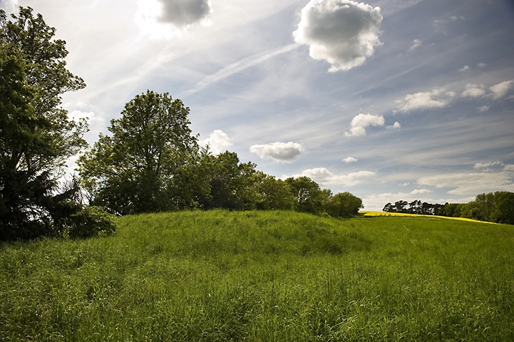
The monument includes a bowl barrow just below the crest of a south east
facing hillside on the Isle of Wight.
The barrow has a mound which measures 18m in diameter and is c.1.4m high.
Surrounding the mound is a ditch from which material was quarried during its
construction. This has become partly infilled over the years but can still be
seen as a slight depression on the south side of the mound c.1.5m wide and
0.2m deep. The remainder will survive as a buried feature.
There is a central depression in the mound c.5m wide. This represents an
excavation conducted in the last century in which an interment was found. The
interment was that of a child in a contracted position. A hammer-head
perforated deer antler was also found in the barrow.
The post and wire fence on the north edge of the mound and the hedgerow fence
are excluded from the scheduling, but the ground beneath is included. The
hedgerow bank is included in the scheduling since it will contain material
from the substance of the barrow.
MAP EXTRACT
The site of the monument is shown on the attached map extract.
It includes a 2 metre boundary around the archaeological features,
considered to be essential for the monument's support and preservation.
Source: Historic England
Bowl barrows, the most numerous form of round barrow, are funerary monuments
dating from the Late Neolithic period to the Late Bronze Age, with most
examples belonging to the period 2400-1500 BC. They were constructed as
earthen or rubble mounds, sometimes ditched, which covered single or multiple
burials. They occur either in isolation or grouped as cemeteries and often
acted as a focus for burials in later periods. Often superficially similar,
although differing widely in size, they exhibit regional variations in form
and a diversity of burial practices. There are over 10,000 surviving bowl
barrows recorded nationally (many more have already been destroyed), occurring
across most of lowland Britain. Often occupying prominent locations, they are
a major historic element in the modern landscape and their considerable
variation of form and longevity as a monument type provide important
information on the diversity of beliefs and social organisations amongst early
prehistoric communities. They are particularly representative of their period
and a substantial proportion of surviving examples are considered worthy of
protection.
The bowl barrow on Nunwell Down survives well and is known from partial
excavation to contain archaeological remains and environmental evidence
relating to the barrow and the landscape in which it was constructed. This
barrow is the survivor of a pair of barrows on this part of Nunwell Down.
Source: Historic England
Books and journals
Isle of Wight archaeological index, (1979)
Grinsell, , Sherwin, , 'Proceedings of the I.O.W. Nat History and Archaeological Soc' in Procedings of the I.O.W. Nat History and Archaeological Soc, , Vol. 3, (1940), 181,209
Other
Title: County Council 6" Map
Source Date: 1951
Author:
Publisher:
Surveyor:
Tomalin, Dr D,
Source: Historic England
Other nearby scheduled monuments