Approximate Location Map
Large Map »
This site is entirely user-supported. See how you can help.
If Google Street View is available, the image is from the best available vantage point looking, if possible, towards the location of the monument. Where it is not available, the satellite view is shown instead.
Latitude: 53.9197 / 53°55'11"N
Longitude: -1.0321 / 1°1'55"W
OS Eastings: 463667.538693
OS Northings: 447499.296787
OS Grid: SE636474
Mapcode National: GBR PR73.CM
Mapcode Global: WHFCB.3QTX
Entry Name: World War II bombing decoy 500m east of Bland's Plantation
Scheduled Date: 7 March 2002
Source: Historic England
Source ID: 1020404
English Heritage Legacy ID: 34828
County: York
Civil Parish: Fulford
Traditional County: Yorkshire
Lieutenancy Area (Ceremonial County): North Yorkshire
Church of England Parish: Heslington St Paul
Church of England Diocese: York
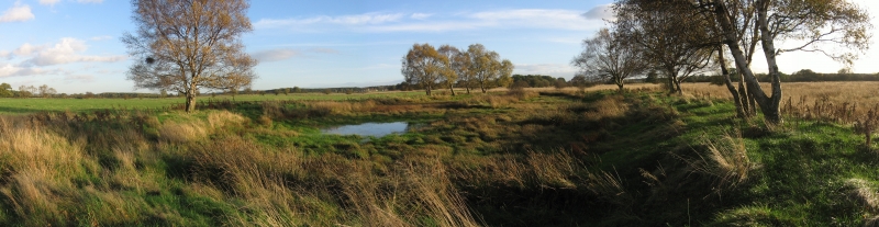
The monument includes earthwork and buried remains of a World War II bombing
decoy site. It is located on an area of unimproved wetland known as Heslington
Tillmire lying to the south of York.
The site was established in order to divert enemy bombers from attacking the
City of York. The monument was one of a series of decoy sites established to
protect 22 historic towns throughout the country which were under threat from
what were known as the Baedeker Raids. York was targeted by one such raid on
the 29th April 1942 when 79 heavy high explosive and several thousand
incendiary bombs were dropped on the city resulting in the deaths of 94
civilian casualties and a number of service personnel. Consequently a decoy
site was established. The first reference to this was in a list dated 12th
May 1942 and the site became operational on the 15th May. It consisted of 40
large baskets of inflammable material, electronically fired from a remote
location. The last reference to the site is 19th December 1942. It is known
that some of the baskets were ignited for test purposes but there is currently
no record of the site having been lit for operational purposes. The site was
under the control of No 4 Bomber Group based at York. It was sited at this
location partly because it was wet ground and thus did not use up valuable
agricultural land needed to provide food as part of the domestic war effort.
The decoy site was a temporary version of what was known as the Starfish type
of decoy. This simulated different types of bomb damage by igniting different
types of fire in separate areas each defined by a firebreak trench excavated
around it.
The firebreaks, which enclosed the fires, survive as clearly identifiable
earthworks. They take the form of shallow ditches measuring up to 1.75m wide
and 0.75m deep, describing irregular shaped enclosures. There are seven such
enclosures spread throughout the area of the monument and they are between 50m
and 175m apart. The enclosures range in size from 50m by 40m to 25m by 20m. In
some cases there is a slight bank on the inner side of the ditches. The area
between the enclosures will contain evidence for the construction and
maintenance of the whole site such as access roads, lightening conductors to
prevent accidental firing and cable ducts. It is known that such roads were
often camouflaged with soil and turf and thus may survive as buried features.
The decoys were operated from a small brick building believed to be located at
NGR SE63904790. This building has been demolished and no longer survives and
is thus not included in the monument.
MAP EXTRACT
The site of the monument is shown on the attached map extract.
Source: Historic England
World War II saw the emergence of aerial bombardment as a decisive instrument
of warfare, and to counter this threat, the United Kingdom maintained a
flexible and diverse mechanism of air defence throughout the war. This
included the early warning of approaching aircraft, through radar and visual
detection, and the local defence of towns, cities and other vulnerable points
using anti-aircraft gunnery and balloon barrages. But less conspicuously, many
potential targets were shadowed by decoys - dummy structures, lighting
displays and fires - designed to draw enemy bombs from the intended points of
attack.
Britain's decoy programme began in January 1940 and developed into a complex
deception strategy, using four main methods: day and night dummy aerodromes
(`K' and `Q' sites); diversionary fires (`QF' sites and `Starfish'); simulated
urban lighting (`QL' sites); and dummy factories and buildings. In all, some
839 decoys are recorded for England in official records, built on 602 sites
(some sites containing decoys of more than one type). This makes up the
greater proportion of the c.1000 decoys recorded for the United Kingdom. The
programme represented a large investment of time and resources. Apart from
construction costs, several thousand men were employed in operating decoys,
the fortunes of which were closely tied to the wartime targets they served.
The decoys were often successful, drawing many attacks otherwise destined for
towns, cities and aerodromes. They saved many lives.
Urban decoy fires were known as `SF', `Special Fires' and `Starfish', to
distinguish them from the smaller `QF' installations. Each town was protected
by a cluster of these decoys, the most technically sophisticated of all the
types, with each Starfish replicating the fire effects an enemy aircrew would
expect to see when their target had been successfully set alight. The decoys
included variation in fire type, duration of burning and speed of ignition. In
a permanent Starfish all fire types were used, set in discrete areas defined
by firebreak trenches and controlled from a remote shelter. The whole array
was linked by a network of metalled access roads. `Temporary Starfish' (all
built in 1942 to counter the threat from the so-called Baedeker raids against
historic towns and cities) only had basket fires. In all, 228 decoys with a
Starfish component are recorded in England, 37 of which were `Temporary
Starfish', and the rest `Permanent'. The Permanent sites were located mostly
in central England, close to the urban and industrial targets they were
intended to protect; temporary sites, like the Baedeker targets they were
protecting, were mostly located in southern and eastern England. QF sites were
first provided for the night protection of RAF airfields, but from August 1941
their role was extended to protect urban centres. Although similar to
Starfish, they differed in being considerably smaller, using a limited range
of fire types and being sited for the local protection of specific vulnerable
points rather than whole cities or conurbations. These new QF sites of 1941-2
fell into four groups, for the protection of: urban and industrial targets
(the `Civil Series', located mostly in the West Midlands, north-west and in
the Middlesbrough area); Royal Navy sites (these were few in number and sited
to protect coastal bases); Army sites, to protect ordnance factories or
military installations (these existed in a sparse belt running from central
southern England into the West Midlands); and oil installations and tank farms
(the `Oil QF' sites). In all, only about 100 QF sites were operational in
England.
Very little now survives of any of these decoys, most having been cleared
after the war. All sites with significant surviving remains will be considered
of national importance, as will those where a well-preserved night shelter has
been identified.
The remains of the firebreaks at Heslington Tillmire survive well and evidence
of their construction and use will be preserved. Important information about
the layout and operational functions of the complex as a whole will be also
preserved within and around the firebreaks.
Source: Historic England
Books and journals
Crawshaw, A, 'Yorkshire Archaeological Journal' in Aerial Archaeology in Yorkshire: A Starfish Site, , Vol. VOL 64, (1992), 209-211
Other
Crawshaw A, (2000)
Pearcy D, (2001)
Source: Historic England
Other nearby scheduled monuments