Approximate Location Map
Large Map »
This site is entirely user-supported. See how you can help.
If Google Street View is available, the image is from the best available vantage point looking, if possible, towards the location of the monument. Where it is not available, the satellite view is shown instead.
Latitude: 52.6703 / 52°40'12"N
Longitude: -2.5497 / 2°32'59"W
OS Eastings: 362922.521488
OS Northings: 308203.185268
OS Grid: SJ629082
Mapcode National: GBR BS.4YV7
Mapcode Global: WH9D7.T41R
Entry Name: Large multivallate and univallate hillforts, a round barrow, a Late Bronze Age settlement and WWII military remains, on The Wrekin
Scheduled Date: 16 May 1934
Last Amended: 22 June 2004
Source: Historic England
Source ID: 1021275
English Heritage Legacy ID: 34933
County: Telford and Wrekin
Civil Parish: Wrockwardine
Traditional County: Shropshire
Lieutenancy Area (Ceremonial County): Shropshire
Church of England Parish: Uppington Holy Trinity
Church of England Diocese: Lichfield
The monument includes the earthwork and buried remains of a large multivallate
hillfort and a large univallate hillfort, the underlying remains of a Late
Bronze Age settlement, together with earthwork and buried remains of a round
barrow, and the earthwork and structural remains of World War II military
installations.
The earliest known visible feature surviving on the summit of The Wrekin is a
Bronze Age round barrow. It was constructed on the highest part of the hill
and is surrounded by the later hillforts. The barrow mound is mainly composed
of stone, is roughly circular and is about 17m in diameter. It has an eroded
profile and now mostly stands to a height of 0.5m, although the south eastern
quadrant is better preserved and stands about 1m high. Although no longer
visible at ground level, a ditch, from which material was quarried to
construct the monument, surrounds the mound. This has become infilled over the
years but survives as a buried feature, approximately 3m wide.
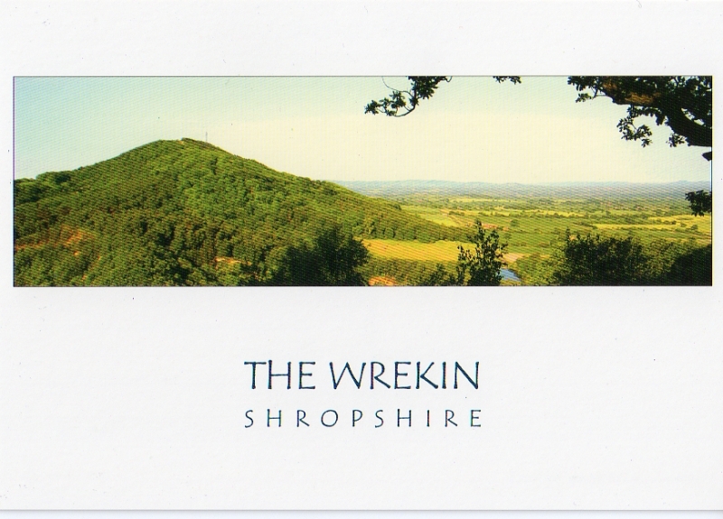
The large multivallate hillfort was built to encompass the whole of the spinal
summit of The Wrekin and from this position there are extensive views in every
direction. The overall dimensions of the hillfort are about 150m north west-
south east by 900m south west-north east. The defensive circuit encloses an
area of approximately 8ha. Its size indicates that it was occupied by a
large community where centralised economic and social activities were
practiced, including the storage and redistribution of food and the performing
of ceremonies. The defensive strength of the hillfort is enhanced by its
topographic location, with the surrounding ground sloping steeply in all
directions. The earthwork defences of the hillfort consist principally of two
ramparts with steep outer faces separated mainly by a narrow ditch. This ditch
has been infilled, but survives as a buried feature. Much of the material for
the construction of the ramparts came from a quarry ditch located behind the
inner rampart. Level areas created during the digging of this ditch would
have provided suitable places for the construction of buildings. The
remains of these buildings, within the partially infilled quarry ditch, will
survive well as buried features. The tops of the ramparts are now mostly
level and, in combination with the adjacent infilled ditches, have the
appearance of terraces running around the sides of the hill. There is no outer
rampart along the south eastern part of the circuit, where the increasing
steepness of the hillside helped to create an effective barrier. Wherever
possible use was made of rock outcrops and cliffs by incorporating them into
the lines of defence.
There are two entrances into the fort: at the north east and the south west.
The one at the north east is known as `Hell Gate'. Here, the ends of the
inner rampart turn inward to form an entrance passage about 3.5m wide. The
entrance passage at the south west is about 2m wide and is flanked by a
series of banks and ditches, now visible as low earthworks. This entrance is
also overlooked by a sizeable rock outcrop on the eastern side.
In 1939 and in 1973 limited archaeological excavations were undertaken on
the summit of The Wrekin. Trenches dug through the defences of the
multivallate hillfort found that the inner rampart was built of deposits
of earth and stone, and that two major periods of construction were
represented. The 1973 excavations also included a small area of this
fort's interior. Remains of post-built structures, associated with
hearths, were found terraced into the hillside. Some of the pottery
discovered indicates that a settlement was established in the Late Bronze
Age, in the 9th and 8th centuries BC, prior to the construction of the
multivallate fort in the Iron Age. It is probable that this early
settlement, like other contemporary examples located on prominent hills in
the region, was enclosed by a palisade or a bank. Radiocarbon dating of
charcoal associated with the post-built structures suggests that the
multivallate hillfort was founded between the 7th and 5th centuries BC.
Additional radiocarbon dates suggest that this part of the hill had ceased
to be intensively occupied by the 5th or 4th century BC. It was during
this period, or slightly later, that the inner defensive circuit (the
univallate hillfort) was constructed around the upper portion of the
summit.
The univallate hillfort is sub-rectangular in plan. Its overall dimensions are
about 150m north west-south east by 395m south west-north east. The
defensive circuit encloses an area of approximately 3.5ha. This hillfort, like
the multivallate fort, would have been occupied by a large community. The
single rampart, which defines the interior, has a steep outer face. It is
largely flat-topped and is bounded by a quarry ditch, now a shallow
depression, to the rear. This ditch, like the internal quarry ditch of the
multivallate hillfort, is likely to contain the well-preserved remains of
buildings. Archaeological trenches dug across the rampart in 1939 demonstrated
that there had been two major episodes of construction. The inital rampart was
built of deposits of earth and stone with an external drystone retaining
wall. Later, the rampart was enlarged by further deposits of earth and stone,
which sealed the retaining wall.
The univallate fort also has two diagonally opposed entrances: one at the
north eastern end (known as `Heaven Gate') and the other to the south west. At
both entrances the rampart is flanked by an outer ditch and an external
counterscarp bank. The ditch at the south western entrance consists of a
series of adjoining pits. At both entrances the ends of the ramparts turn
inward to form entrance passages between 2m and 2.5m wide. The south western
entrance was partially excavated in 1939 and at least two periods of
construction were revealed. Initially, there was a short entrance passage.
Later, the entrance passage was lengthened and a stone revetment wall built
against its internal faces. Guard chambers on either side of passageway were
also constructed. The revetment wall was built of well-laid sandstone blocks,
which are not native to the hill. The south western guard chamber was
completely exposed, and was found to be rectangular in plan and formed a
recess 2.9m by 4.6m. Its walls were constructed of stone and wood, and
consisted of regularly placed posts between which was a rubble-built retaining
wall of irregular and locally derived stones. The opposite chamber was
partially excavated and would appear to be of a similar size and construction
to the one to the south east. Close to the entrance passage, overlying the
original bank, a burnt deposit was found, suggesting that entrance had been
rebuilt after a fire.
As part of the investigation undertaken in 1939, a very limited area of the
interior of the univallate fort close to the south west entrance was
excavated. The remains of post-built structures and storage pits were
discovered, indicating the fort had been intensively occupied.
Structural evidence from the 1973 excavation, supported by radiocarbon dates,
suggests that about a hundred years after the univallate fort was constructed
the multivallate fort was reoccupied. Radiocarbon dates obtained from a burnt
timber and a quantity of burnt grain indicate that occupation on The Wrekin
ceased about the middle of the first century AD. It is possible that the
settlement here was deliberately destroyed by the advancing Roman legionary
forces under Scapula in AD 48 or 50. Supporting evidence for this suggestion
has come from the finding of two Roman javelin heads dating from the mid-
first century, one from the hillfort itself and the other from the lower
slopes of the adjacent Ercall Hill to the north east.
During World War II a searchlight battery was established on the summit of The
Wrekin in order to detect enemy aircraft. It would have consisted of
searchlights, a command post, a sound locator, and weapon pits for light
Anti-aircraft guns. Remains of the searchlight battery lie within the
southern part of the univallate hillfort close to the south west entrance. The
positions of the searchlights are indicated by four regularly placed circular
embanked enclosures in a straight line, each about 8.5m across, with a central
depression in which a searchlight, 90cm in diameter, would have sat. The
larger embanked oval enclosure would have served as a command post, close to
which would have been the sound locator for pin-pointing the position of
enemy aircraft prior to the use of the searchlights. Three weapon pits,
circular embanked enclosures about 5.5m in diameter, are located a short
distance away to the south west and north east.
To the north east of the searchlight battery is a rectangular concrete
platform, measuring 3.05m by 4.26m, built next to the rampart of the
univallate hillfort. It served as the base for an aircraft warning beacon,
known as a Pundit or Chance Light. It was erected in 1943 following the crash
of an allied aircraft into the hill. The beacon was dismantled in 1970.
In 1973 a television transmission station was constructed on the north western
side of the multivallate hillfort. The transmission station, all modern track
surfaces, fences, the waymarker post, the toposcope and the Ordnance Survey
triangulation pillar and the concrete bases on which they stand are excluded
from the scheduling. However, the ground beneath all these features is
included.
MAP EXTRACT
The site of the monument is shown on the attached map extract.
It includes a 2 metre boundary around the archaeological features,
considered to be essential for the monument's support and preservation.
Source: Historic England
Large multivallate hillforts are defined as fortified enclosures of between
5ha and 85ha in area, located on hills and defined by two or more lines of
concentric earthworks set at intervals of up to 15m. They date to the Iron
Age period, most having been constructed and used between the sixth century BC
and the mid-first century AD. They are generally regarded as centres of
permanent occupation, defended in response to increasing warfare, a reflection
of the power struggle between competing elites.
Earthworks usually consist of a rampart and ditch, although some only have
ramparts. Access to the interior is generally provided by two entrances
although examples with one and more than two have been noted. These may
comprise a single gap in the rampart, inturned or offset ramparts,
oblique approaches, guardrooms or outworks. Internal features generally
include evidence for intensive occupation, often in the form of oval or
circular houses. These display variations in size and are often clustered,
for example, along streets. Four- and six-post structures, interpreted as
raised granaries, also occur widely while a few sites appear to contain
evidence for temples. Other features associated with settlement include
platforms, paved areas, pits, gullies, fencelines, hearths and ovens.
Additional evidence, in the form of artefacts, suggests that industrial
activity such as bronze- and iron-working as well as pottery manufacture
occurred on many sites.
Large multivallate hillforts are rare with around 50 examples recorded
nationally. These occur mostly in two concentrations, in Wessex and the Welsh
Marches, although scattered examples occur elsewhere.
In view of the rarity of large multivallate hillforts and their importance in
understanding the nature of social organisation within the Iron Age period,
all examples with surviving archaeological potential are believed to be of
national importance.
Large univallate hillforts are defined as fortified enclosures of varying
shape, ranging in size between 1ha and 10ha, located on hilltops and
surrounded by a single boundary comprising earthworks of massive proportions.
They date to the Iron Age period, most having been constructed and used
between the fourth century BC and the first century AD, although evidence for
earlier use is present at most sites. The size of the earthworks reflects the
ability of certain social groups to mobalise the labour necessary for works on
such a monumental scale, and their function may have had as much to do with
display as defence. Large univallate hillforts are rare nationally. Most are
located in southern England, while further examples occur in central and
western England, with outliers further north.
Round barrows are funerary monuments dating from the Late Neolithic to the
Late Bronze Age, with most examples belonging to the period 2400-1500 BC. They
were constructed as earthen mounds, sometimes ditched, which covered single or
multiple burials.
The large multivallate hillfort, the large univallate hillfort and the
round barrow, which were constructed on the summit of The Wrekin, are good
examples of these classes of monument. The enclosure of one hillfort type
with another is most unusual. The location of these hillforts allows
comparisons and distinctions to be made about their construction, the
nature of their occupation and the range of activities performed.
Archaeological excavations carried out here have demonstrated that
domestic occupation of the hilltop began in the early first millennium BC
and lasted for about 800 years. These excavations have shown that buried
structural features and associated deposits survive well and contain a
variety of artefacts, most notably pottery, and contemporary organic
remains. Together the buried remains will provide significant evidence for
the changing nature of life in the region during the Later Bronze Age and
throughout the Iron Age.
The survival of the round barrow as an earthwork suggests that it
continued to act as an important feature within the Bronze Age settlement
and the later hillforts. The barrow mound will retain evidence for its
method of construction as well as the burial or burials within it. These
remains will add to our knowledge and understanding of Bronze Age funerary
practices in this area.
During World War II the strategic importance of The Wrekin was again
realised when a searchlight battery was established here. The various
components of the battery survive well, and provide a clear illustration
of the layout and functioning of an aircraft detection unit at this time.
The importance of the battery is further enhanced by its proximity to the
remains of an aircraft warning beacon.
Source: Historic England
Books and journals
Burrows, D, Troublesome past of beacon on the blink, (2001)
Cunliffe, B, Iron Age Communities in Britain, (1991), 362-63
Evans, G, Secrets of The Wrekin Forest, (1992), 18
Kenyon, K M, 'Archaeological Journal' in Excavations on The Wrekin, Shropshire, 1939, (1942), 99-109
Kenyon, K M, 'Archaeological Journal' in Excavations on The Wrekin, Shropshire, 1939, (1942), 99-109
Stanford, S C, 'Archaeological Journal' in The Wrekin Hillfort Excavations 1973, , Vol. 141, (1984), 61-90
White, R H, Webster, G, 'Transactions of the Shropshire Archaeological Society' in Two Roman Javelin Heads from The Wrekin Hillfort, Shropshire, , Vol. 69, (1994), 126-28
Other
Royle, C and Woodward, A, The Prehistoric Pottery, 1993, Well-dated LBA-EIA pottery sequence
Thomas, R, (2002)
Source: Historic England
Other nearby scheduled monuments