Approximate Location Map
Large Map »
This site is entirely user-supported. See how you can help.
If Google Street View is available, the image is from the best available vantage point looking, if possible, towards the location of the monument. Where it is not available, the satellite view is shown instead.
Latitude: 56.3793 / 56°22'45"N
Longitude: -5.5178 / 5°31'3"W
OS Eastings: 182903
OS Northings: 726334
OS Grid: NM829263
Mapcode National: GBR DCRV.PC8
Mapcode Global: WH0GK.6XRF
Entry Name: Dun Ormidale, fort 345m NNE of Gallanach
Scheduled Date: 23 December 1978
Last Amended: 7 February 2013
Source: Historic Environment Scotland
Source ID: SM4182
Schedule Class: Cultural
Category: Prehistoric domestic and defensive: fort (includes hill and promontory fort)
Location: Kilmore and Kilbride
County: Argyll and Bute
Electoral Ward: Oban South and the Isles
Traditional County: Argyllshire
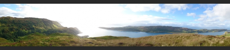
The monument is a prehistoric or early historic fort, built and used probably between 1500 BC and AD 800. It is visible as a hilltop bounded by steep and in places vertical slopes, augmented by the remains of a wall which is present intermittently around the N and E. The fort occupies the whole of the sloping summit of the hill, which rises from 140m to 160m above sea level. The total area of the fort is about 3ha. The fort stands 300m from the W coast of Argyll, and commands exceptional views N and S along the Sound of Kerrera and beyond. The monument was first scheduled in 1978, but the documentation does not meet modern standards: the present rescheduling rectifies this.
The area to be scheduled is irregular on plan, to include the hilltop and the steep slopes immediately around it. The scheduling includes the remains described above and an area around them within which evidence relating to the monument's construction, use and abandonment may survive, as shown in red on the accompanying map. The scheduling specifically excludes the memorial cairn on the S side of the hilltop and the above-ground elements of post-and-wire fences.
Source: Historic Environment Scotland
Cultural Significance
The monument's cultural significance can be expressed as follows:
Intrinsic characteristics
The fort survives in stable condition. There are sheer rock faces to the S and W and there are no traces of manmade defensive works on these sides. To the N and E, a band of stony debris, mostly turf-covered, indicates the position of a defensive wall. Outer facing stones have been identified in the NE corner. On the N side a gap about 3m wide aligns with a winding track that climbs the grassy slopes, and probably represents the original entrance. The one other natural approach to the plateau is to the E, but no wall remains are visible near this second possible access route. There are no surface indications of buildings within the fort's interior.
Despite the relatively slight, upstanding manmade remains, the fort is of great interest as by far the largest defended site in Lorn. There is a high probability of buried remains, potentially ranging from the late Bronze Age or Iron Age to the medieval period. As such, the site carries significant potential for answering questions about the date, nature and development sequence of defensive sites in western Scotland. There is potential to examine the form and construction of the defences and of any internal buildings. Postholes, pits or ditches may contain artefacts or ecofacts that can provide information about the peoples that used the site, potentially providing information about the economy, contacts and social status of the occupants, and whether occupation was of short or long duration, and whether it was continuous, episodic or seasonal. While some forts were exclusively occupied in the late Bronze Age or Iron Age, others such as Dunadd may have been completely new fortifications of the early medieval period. Dating the occupation of this particularly large fort would be a significant advance in archaeological knowledge.
Contextual characteristics
Although this monument has a 'dun' prefix in its place-name, it is definitely to be regarded as a fort. Researchers apply the word 'dun' to much smaller strongholds, typically around 20m in diameter. Forts are less common than duns in western Scotland, representing around 10% of the total number of defensive enclosures. Dun Ormidale stands on a dominant hill 300m inland from the coast at its nearest point, but it overlooks two duns placed close to the shore: one 420m to the NW, and the other 550m to the SW. It also stands roughly opposite a smaller fort situated 1.5km to the NW, across the Sound of Kerrera. These three other sites may have been positioned with reference to Dun Ormidale, though their relative dates are not yet known. Study of these monuments, and of others in the vicinity, has significant potential to refine their dating and enhance our knowledge of settlement pattern and the use of defensive sites in the later prehistoric and early historic periods. Further afield, Dun Ormidale can be compared with Cnoc Araich in Kintyre, a multivallate fort of 2.5ha which also lacks upstanding buildings, and with The Doon, Arran, a headland fort of around 5ha where the remains of houses were once reported but are not now visible.
Associative characteristics
Dun Ormidale is depicted and labeled on the Ordnance Survey 1st edition map.
National Importance
The monument is of national importance as an example of a prehistoric or early historic fortification with an irregular internal area defined by natural slopes and a stone wall. It has an inherent potential to make a significant addition to our understanding of the past, in particular of defensive sites in western Scotland and the Irish Sea region. Dun Ormidale has particular importance as by far the largest defended site in this part of western Scotland and has high potential for well-preserved archaeological remains surviving within and immediately outside the fort. The loss of the monument would significantly diminish our future ability to appreciate and understand early Scottish communal fortifications.
Source: Historic Environment Scotland
Bibliography
RCAHMS records the site as CANMORE 22942. The West of Scotland Archaeology Service SMR reference is 1132.
References
Harding, D W, 1997 'Forts, Duns, Brochs and Crannogs: Iron Age Settlements in Argyll', in Ritchie, G (ed.) The Archaeology of Argyll, pp. 118-40, Edinburgh.
The Royal Commission on the Ancient and Historical Monuments of Scotland, 1975, Argyll: an inventory of the monuments, volume 2: Lorn, Edinburgh. pp. 70, No 137.
Source: Historic Environment Scotland
Other nearby scheduled monuments