Approximate Location Map
Large Map »
This site is entirely user-supported. See how you can help.
If Google Street View is available, the image is from the best available vantage point looking, if possible, towards the location of the monument. Where it is not available, the satellite view is shown instead.
Latitude: 54.4109 / 54°24'39"N
Longitude: -0.9519 / 0°57'6"W
OS Eastings: 468119.497661
OS Northings: 502225.587316
OS Grid: NZ681022
Mapcode National: GBR PKSF.PK
Mapcode Global: WHF91.BDYC
Entry Name: Western Howes round barrows, 250m north west of White Cross
Scheduled Date: 19 June 2000
Source: Historic England
Source ID: 1018988
English Heritage Legacy ID: 32647
County: North Yorkshire
Civil Parish: Danby
Traditional County: Yorkshire
Lieutenancy Area (Ceremonial County): North Yorkshire
Church of England Parish: Westerdale Christ Church
Church of England Diocese: York
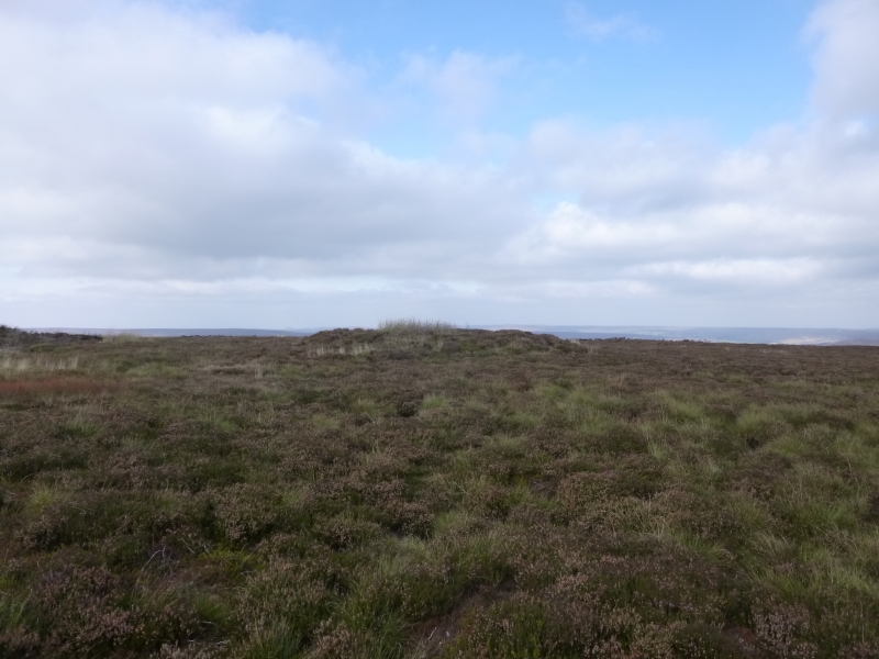
The monument includes buried and earthwork remains of a group of three
prehistoric burial mounds. The round barrows are located on the northern edge
of the plateau which forms the central watershed of the North York Moors, the
land surface gently sloping away to the north to form Castleton Rigg. They are
prominently sited, with the larger two barrows being part of the skyline when
viewed from the north. All three barrows were investigated by Canon Atkinson,
vicar of Danby, in 1863. The central barrow is the largest. It is 11m in
diameter, standing 1m high. At the centre of this barrow, Atkinson uncovered a
carefully built stone cairn, encased by large flat slabs, which was just over
4m in diameter. About 2.5m east of its centre there were two Bronze Age
cremation urns. One contained a small amount of cremated bone, a granite
battle-axe, a small cup, a bone toggle and parts of four bone pins. The second
contained cremated bone along with parts of two further burnt bone pins. The
excavation hollow left by Atkinson is 5m in diameter and 0.5m deep.
The eastern barrow is approximately 25m north east of the central barrow. This
is just under 11m in diameter and is 0.7m high, and also with a central
excavation hollow 5m in diameter and 0.5m deep. Atkinson noted that this
barrow was constructed of earth and some stone with a large, irregularly
shaped stone at its centre which he believed to have been naturally sited.
The smallest barrow lies 40m to the west of the central barrow. It is 6m in
diameter and at most 0.3m high with a small central excavation hollow.
Atkinson recorded that this contained a deposit of cremated bone and charcoal
on top of a naturally sited stone.
Although there are no ditches visible around the barrows, excavations of other
examples in the region have shown that, even where no encircling depression is
discernible on the modern ground surface, ditches immediately around the
outside of barrows frequently survive as infilled features, containing
additional archaeological deposits. Investigations in the 20th century of
barrow groups have also revealed the presence of flat graves between barrows.
These burials without covering mounds are of especial interest, so that the
ground between the barrows is considered to be archaeologically sensitive and
worthy of protection.
MAP EXTRACT
The site of the monument is shown on the attached map extract.
It includes a 2 metre boundary around the archaeological features,
considered to be essential for the monument's support and preservation.
Source: Historic England
Round barrows are funerary monuments dating from the Late Neolithic period to
the Late Bronze Age, with most examples belonging to the period 2400-1500 BC.
They were constructed as earthen mounds, sometimes ditched, which covered
single or multiple burials. They occur either in isolation or grouped as
cemeteries and often acted as a focus of burials in later periods. Often
superficially similar, although differing widely in size, they exhibit
regional variations in form and a diversity of burial practices. There are
over 10,000 surviving examples recorded nationally (many more have already
been destroyed), occurring across most of Britain, including the Wessex area
where it is often possible to classify them more closely, for example as bowl
or bell barrows. Often occupying prominent locations, they are a major
historic element in the modern landscape and their considerable variation in
form and longevity as a monument type provide important information on the
diversity of beliefs and social organisations amongst early prehistoric
communities. They are particularly representative of their period and a
substantial proportion of surviving examples are considered worthy of
protection.
The majority of round barrows in the region were dug into by 19th century
antiquarians in search of burials and artifacts, leaving behind a central
depression as evidence of their work. However, excavations in the latter half
of the 20th century have shown that round barrows typically contain
archaeological information that survives earlier digging. These excavations
demonstrate a wide range of burial rites, from simple scatters of cremated
material to coffin inhumations and cremations contained in urns, typically
dating to the Bronze Age. A common factor is that barrows were normally used
for more than one burial and that the primary burial was frequently on or
below the original ground surface, often with secondary burials located within
the body of the mound which were frequently missed by antiquarian excavators.
The three Western Howes barrows 250m north west of White Cross form an
important, prominently sited group of burial mounds. The survival of records
of the antiquarian investigation of these barrows adds to their significance.
Source: Historic England
Books and journals
Smith, M J B, Excavated Bronze Age Burial Mounds of Durham and N' land., (1994), 57
Smith, M J B, Excavated Bronze Age Burial Mounds of Durham and N' land., (1994), 56
Source: Historic England
Other nearby scheduled monuments