Approximate Location Map
Large Map »
This site is entirely user-supported. See how you can help.
If Google Street View is available, the image is from the best available vantage point looking, if possible, towards the location of the monument. Where it is not available, the satellite view is shown instead.
Latitude: 54.3857 / 54°23'8"N
Longitude: -1.0521 / 1°3'7"W
OS Eastings: 461653.49989
OS Northings: 499324.18
OS Grid: SE616993
Mapcode National: GBR PK3Q.0M
Mapcode Global: WHF95.T156
Entry Name: Round cairn in High Plantation, 840m north east of Cockayne Lodge
Scheduled Date: 9 February 2001
Source: Historic England
Source ID: 1019597
English Heritage Legacy ID: 32710
County: North Yorkshire
Civil Parish: Bransdale
Traditional County: Yorkshire
Lieutenancy Area (Ceremonial County): North Yorkshire
Church of England Parish: Kirkbymoorside All Saints
Church of England Diocese: York
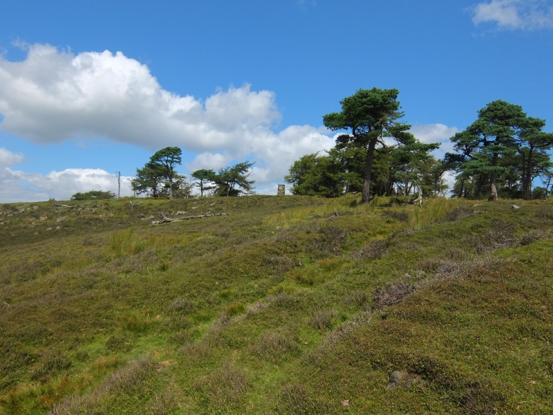
The monument includes the earthwork and associated buried remains of a
prehistoric burial mound constructed mainly of stones on the southern edge of
Bransdale Moor, immediately south of the drystone wall defining the northern
boundary of High Plantation.
The cairn is sited on level ground around 50m back from the break of slope
between the plateau forming Bransdale Moor and the hillside down into the
dale. From it there is a fine view down the length of Bransdale and the cairn
would have formed a skyline feature when viewed from the rest of the moor to
the north. Intervisibility of the monument with other cairns along Bransdale
Ridge to the west and with the Three Howes round barrows on Rudland Rigg to
the south east is partly obscured by trees within the plantation. The monument
is also intervisible with a prehistoric standing stone, Cammon Stone, on
Rudland Rigg 1.2km to the north east.
The cairn is 11m in diameter, standing to 0.6m high with a 5m diameter flat or
slightly concave top. It is mainly grassed over, but a small area of
disturbance in the north east quadrant shows that the cairn is mainly built of
stones, typically with 0.3m to 0.5m maximum dimension. Excavation of other
examples of round cairns in the region have shown that even where no
encircling depression is discernible on the modern ground surface, ditches
immediately around the outside of the mound frequently survive as infilled
features, containing additional archaeological deposits. A margin to allow for
such an infilled ditch up to 2m wide around the cairn is thus also included
within the monument.
MAP EXTRACT
The site of the monument is shown on the attached map extract.
It includes a 2 metre boundary around the archaeological features,
considered to be essential for the monument's support and preservation.
Source: Historic England
Round cairns are prehistoric funerary monuments dating to the Bronze Age
(c.2000-700 BC). They were constructed as stone mounds covering single or
multiple burials. These burials may be placed within the mound in stone-lined
compartments called cists. In some cases the cairn was surrounded by a ditch.
Often occupying prominent locations, cairns are a major visual element in the
modern landscape. They are a relatively common feature of the uplands and are
the stone equivalent of the earthen round barrows of the lowlands. Their
considerable variation in form and longevity as a monument type provide
important information on the diversity of beliefs and social organisation
amongst early prehistoric communities. They are particularly representative of
their period and a substantial proportion of surviving examples are considered
worthy of protection.
Excavation of round cairns in the region have shown that they demonstrate a
very wide range of burial rites from simple scatters of cremated material to
coffin inhumations and cremations contained in urns, typically dating to the
Bronze Age. A common factor is that round cairns were normally used for more
than one burial and that the primary burial was frequently on or below the
original ground surface, often with secondary burials located within the body
of the mound. Most also include a small number of grave goods. These are often
small pottery food vessels, but stone, bone, jet and bronze items have also
occasionally been found. In the Bronze Age, many round cairns are thought to
have acted as territorial markers in addition to their role as burial sites.
The round cairn in High Plantation, 840m north east of Cockayne Lodge is a
very well-preserved example of a small prominently placed cairn. Unlike most
burial mounds in the area, it appears to have escaped excavation by 19th
century antiquarians.
Source: Historic England
Other nearby scheduled monuments