Approximate Location Map
Large Map »
This site is entirely user-supported. See how you can help.
If Google Street View is available, the image is from the best available vantage point looking, if possible, towards the location of the monument. Where it is not available, the satellite view is shown instead.
Latitude: 54.3873 / 54°23'14"N
Longitude: -0.8666 / 0°51'59"W
OS Eastings: 473701.935752
OS Northings: 499685.588752
OS Grid: SE737996
Mapcode National: GBR QKDQ.51
Mapcode Global: WHF92.NZKH
Entry Name: Shunner Howe round barrow
Scheduled Date: 11 June 1968
Last Amended: 4 February 1999
Source: Historic England
Source ID: 1018763
English Heritage Legacy ID: 30156
County: North Yorkshire
Civil Parish: Rosedale East Side
Traditional County: Yorkshire
Lieutenancy Area (Ceremonial County): North Yorkshire
The monument includes the buried and earthwork remains of a prehistoric burial
mound which was later used to mark the junction between four parishes:
Glaisdale, Egton , Rosedale East Side and Hartoft. Shunner Howe, which means
`look-out hill' in Old Norse, is sited at the top of a hill which forms the
south eastern spur of Glaisdale High Moor.
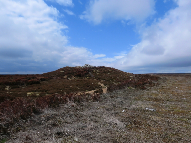
Shunner Howe survives as a 25m diameter mound of earth and stone standing up
to 2.5m high. It has a shallow 7m diameter central depression which is
considered to be the result of an excavation, probably by James Rutter in the
early 1850s. At the centre of this depression there is a small modern cairn of
stones which marks the footpath that skirts the north side of the barrow.
Around the southern side of the mound there is a 4m wide ditch with a 3m wide
external bank which are both included in the scheduling.
MAP EXTRACT
The site of the monument is shown on the attached map extract.
It includes a 2 metre boundary around the archaeological features,
considered to be essential for the monument's support and preservation.
Source: Historic England
Bowl barrows, the most numerous form of round barrow, are funerary monuments
dating from the Late Neolithic period to the Late Bronze Age, with most
examples belonging to the period 2400-1500 BC. They were constructed as
earthen or rubble mounds, sometimes ditched, which covered single or multiple
burials. They occur either in isolation or grouped as cemeteries and often
acted as a focus for burials in later periods. Often superficially similar,
although differing widely in size, they exhibit regional variations in form
and a diversity of burial practices. There are over 10,000 surviving bowl
barrows recorded nationally (many more have already been destroyed), occurring
across most of lowland Britain. Often occupying prominent locations, they are
a major historic element in the modern landscape and their considerable
variation of form and longevity as a monument type provide important
information on the diversity of beliefs and social organisations amongst early
prehistoric communities. They are particularly representative of their period
and a substantial proportion of surviving examples are considered worthy of
protection.
Shunner Howe is an important and well preserved example of a prominently
sited large barrow. Excavations of round barrows in the region have shown
that they demonstrate a very wide range of burial rites from simple scatters
of cremated material to coffin inhumations and cremations contained in urns,
typically dating to the Bronze Age. A common factor is that barrows were
normally used for more than one burial and that the primary burial was
frequently on or below the original ground surface, often with secondary
burials located within the body of the mound. Modern excavations of barrows
that were opened by 19th century antiquarians have shown that secondary and
even primary burials frequently survive undisturbed. Most barrows include a
small number of grave goods. These are often small pottery food vessels, but
stone, bone, jet and bronze items have also occasionally been found. Shallow
ditches and/or stone kerbs immediately encircling the mounds are also quite
common.
Source: Historic England
Other nearby scheduled monuments